IMAGES TAKEN NEAR TO
Hamilton Row, DURHAM, DH7 9AU
Introduction
This page details the photographs taken nearby to Hamilton Row, DH7 9AU by members of the Geograph project.
The Geograph project started in 2005 with the aim of publishing, organising and preserving representative images for every square kilometre of Great Britain, Ireland and the Isle of Man.

There are currently over 7.5m images from over14,400 individuals and you can help contribute to the project by visiting https://www.geograph.org.uk
Image Map
Images are licensed for reuse under creativecommons.org/licenses/by-sa/2.0
Notes
- Clicking on the map will re-center to the selected point.
- The higher the marker number, the further away the image location is from the centre of the postcode.
Image Listing (20 Images Found)
Images are licensed for reuse under creativecommons.org/licenses/by-sa/2.0
Image
Details
Distance
1
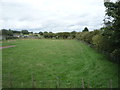
Grazing, Waterhouses
Looking north east beside a disused railway.
Image: © JThomas
Taken: 27 Aug 2018
0.08 miles
2
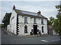
The Black Horse Inn, Waterhouses
A 19th century inn at the junction of Hamilton Row with Wolsingham Road.
Image: © JThomas
Taken: 27 Aug 2018
0.11 miles
3
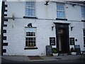
Black Horse Inn, Waterhouses
At the junction of Hamilton Row with Wolsingham Road
Image: © Stanley Howe
Taken: 21 Sep 2013
0.11 miles
4
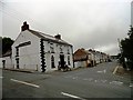
The Black Horse Inn, Waterhouses
This 19th century inn is located at the west end of the former mining village.
Image: © Robert Graham
Taken: 10 Jul 2013
0.11 miles
7
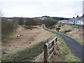
Deerness Valley Railway Path at Waterhouses
This path, one of many railway paths in County Durham, follows the line of an old railway from Durham to Crook. The railway was opened in 1858, closed to passengers in 1951 and finally closed in 1964.
Image: © Oliver Dixon
Taken: 15 Mar 2013
0.14 miles
8
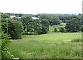
Meadow near Waterhouses
Waterhouses village can be seen in the distance.
Image: © Oliver Dixon
Taken: 17 Jul 2020
0.14 miles
9
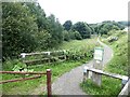
Deerness Valley Walk
The Deerness Valley Walk is one of a number of railway paths for walkers and cyclists in County Durham. This one runs from the outskirts of Durham City via Esh Winning to Crook. The railway was opened in 1858, closed to passengers in 1951 and finally closed in 1964. Compare with Image
Image: © Oliver Dixon
Taken: 17 Jul 2020
0.15 miles