IMAGES TAKEN NEAR TO
Brancepeth, DURHAM, DH7 8DW
Introduction
This page details the photographs taken nearby to DH7 8DW by members of the Geograph project.
The Geograph project started in 2005 with the aim of publishing, organising and preserving representative images for every square kilometre of Great Britain, Ireland and the Isle of Man.

There are currently over 7.5m images from over14,400 individuals and you can help contribute to the project by visiting https://www.geograph.org.uk
Image Map
Images are licensed for reuse under creativecommons.org/licenses/by-sa/2.0
Notes
- Clicking on the map will re-center to the selected point.
- The higher the marker number, the further away the image location is from the centre of the postcode.
Image Listing (8 Images Found)
Images are licensed for reuse under creativecommons.org/licenses/by-sa/2.0
Image
Details
Distance
1
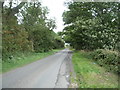
Wolsingham Road near Quarry Hill
Looking south east.
Image: © JThomas
Taken: 27 Aug 2018
0.04 miles
2
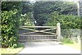
A gated entrance to Quarry Hill
From Wolsingham Road, near Brancepeth.
Image: © Stanley Howe
Taken: 21 Sep 2013
0.07 miles
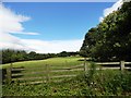
3
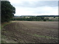
Field near Quarry Hill
South of Wolsingham Road.
Image: © JThomas
Taken: 27 Aug 2018
0.07 miles
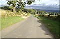
4
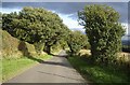
Downhill Wolsingham Road
Approaching Quarry Hill and Brancepeth.
Image: © Stanley Howe
Taken: 21 Sep 2013
0.13 miles
5
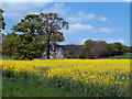
Quarryhill Cottages
Quarryhill Cottages are seen over a field of flowering oil seed rape from a minor road just outside the village of Brancepeth.
Image: © Trevor Littlewood
Taken: 3 May 2011
0.20 miles
6
Wolsingham Road
Downhill towards Brancepeth, from close to Brawn's Den access lane.
Image: © Stanley Howe
Taken: 21 Sep 2013
0.22 miles
7
Looking north from the old railway
View north from just west of the junction of the Brandon-Bishop Auckland Walk with Wolsingham Lane at Brancepeth. Stockley Gill Wood to the left.
Image: © Robert Graham
Taken: 24 Jul 2012
0.24 miles
8
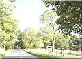
Approach to Brancepeth
Along Wolsingham Road.
Image: © Stanley Howe
Taken: 21 Sep 2013
0.25 miles