
IMAGES TAKEN NEAR TO
Relly Close, DURHAM, DH7 7NW
Introduction
This page details the photographs taken nearby to Relly Close, DH7 7NW by members of the Geograph project.
The Geograph project started in 2005 with the aim of publishing, organising and preserving representative images for every square kilometre of Great Britain, Ireland and the Isle of Man.

There are currently over 7.5m images from over14,400 individuals and you can help contribute to the project by visiting https://www.geograph.org.uk
Image Map
Images are licensed for reuse under creativecommons.org/licenses/by-sa/2.0
Notes
- Clicking on the map will re-center to the selected point.
- The higher the marker number, the further away the image location is from the centre of the postcode.
Image Listing (6 Images Found)
Images are licensed for reuse under creativecommons.org/licenses/by-sa/2.0
Image
Details
Distance
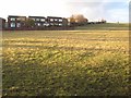
2
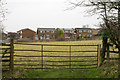
Field beyond metal gate
The field lies on the west side of a lane rising from the B6302 at the west end of the village of Broompark. The modern houses beyond the field maybe considered as being in Broompark or the neighbouring village of Ushaw Moor; they are closer to the former but the estate is more contiguous with the latter.
Image: © Trevor Littlewood
Taken: 25 Dec 2015
0.19 miles
3
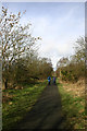
The Deerness Valley Walk
The disused railway track between Broom Park and Crook is now the Deerness Valley Walk. This view is just to the East of Ushaw Moor.
Image: © Uncredited
Taken: 16 Mar 2005
0.20 miles
4
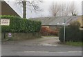
Entrance for footpath off Broom Lane (B6302) in Broompark
Image: © Peter Robinson
Taken: 6 Jan 2013
0.23 miles
5
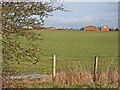
Deerness Leisure Centre, Ushaw Moor
Seen from the Deerness Railway Path.
Image: © Oliver Dixon
Taken: 11 Feb 2007
0.23 miles
6
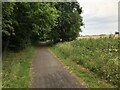
Deerness Valley Railway Path
The Deerness Valley Railway was constructed by the North Eastern Railway primarily to serve collieries along the Deerness valley between Durham and Waterhouses. Beyond Waterhouses the line ran on to Crook as the Stockton & Darlington Railway's Deerness Branch. The line opened to goods in 1858 and passengers in 1877. The passenger service was withdrawn in 1951, with final closure in 1964. The trackbed is now a multi user trail.
Image: © David Robinson
Taken: 17 Jul 2022
0.24 miles