IMAGES TAKEN NEAR TO
Angel View, DURHAM, DH7 6FD
Introduction
This page details the photographs taken nearby to Angel View, DH7 6FD by members of the Geograph project.
The Geograph project started in 2005 with the aim of publishing, organising and preserving representative images for every square kilometre of Great Britain, Ireland and the Isle of Man.

There are currently over 7.5m images from over14,400 individuals and you can help contribute to the project by visiting https://www.geograph.org.uk
Image Map
Images are licensed for reuse under creativecommons.org/licenses/by-sa/2.0
Notes
- Clicking on the map will re-center to the selected point.
- The higher the marker number, the further away the image location is from the centre of the postcode.
Image Listing (14 Images Found)
Images are licensed for reuse under creativecommons.org/licenses/by-sa/2.0
Image
Details
Distance
1
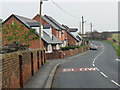
Angel View, Edmondsley
Presumably so called because they command a view of the"Angel of the North" Image, albeit rather distant.
Image: © Oliver Dixon
Taken: 31 Oct 2014
0.01 miles
4
Start of nature walk Edmondsley Co Durham
Image: © P Glenwright
Taken: 23 Sep 2006
0.17 miles

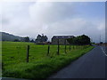
6
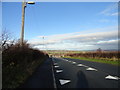
Looking north down Edmondsley Lane
View from the top of the bank above the village, with extensive views to the north and east.
Image: © Robert Graham
Taken: 28 Nov 2012
0.18 miles
7
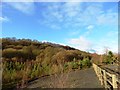
Sacriston Woods from Daisy Hill
Looking up to the woods from the south end of the village of Daisy Hill. The escarpment with its wooded slopes is a very prominent landmark in the area and can be seen from many miles away.
Image: © Robert Graham
Taken: 28 Nov 2012
0.21 miles
8
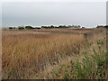
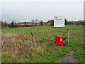
Edmondsley Reedbeds
Part of the Edmondsley Wildlife Habitat established in 1999. Contaminated mine water is filtered through the reedbeds before being returned to the Cong Burn.
Image: © Oliver Dixon
Taken: 31 Oct 2014
0.21 miles
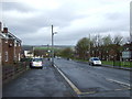
9
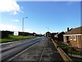
View west along Edmondsley Road
Looking along the road to the crossroads with B6532 in the centre of the village.
Image: © Robert Graham
Taken: 28 Nov 2012
0.21 miles
10
Edmondsley Minewater Treatment Scheme
Part of the Edmondsley Wildlife Habitat established in 1999. Contaminated mine water is filtered through the reedbeds which can be seen in the distance before being returned to the Cong Burn.
Image: © Oliver Dixon
Taken: 31 Oct 2014
0.22 miles