IMAGES TAKEN NEAR TO
Edmondsley, DURHAM, DH7 6EY
Introduction
This page details the photographs taken nearby to DH7 6EY by members of the Geograph project.
The Geograph project started in 2005 with the aim of publishing, organising and preserving representative images for every square kilometre of Great Britain, Ireland and the Isle of Man.

There are currently over 7.5m images from over14,400 individuals and you can help contribute to the project by visiting https://www.geograph.org.uk
Image Map
Images are licensed for reuse under creativecommons.org/licenses/by-sa/2.0
Notes
- Clicking on the map will re-center to the selected point.
- The higher the marker number, the further away the image location is from the centre of the postcode.
Image Listing (15 Images Found)
Images are licensed for reuse under creativecommons.org/licenses/by-sa/2.0
Image
Details
Distance
1
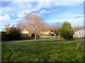
West Edmondsley Farm
Viewed looking north from the minor road from Edmondsley village.
Image: © Robert Graham
Taken: 28 Nov 2012
0.02 miles
2
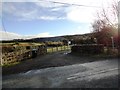
Lane at West Edmondsley
This is the north end of Charlaw Lane, where it joins the minor road leading west from Edmondsley village.
Image: © Robert Graham
Taken: 28 Nov 2012
0.04 miles
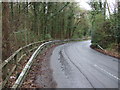
4
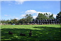
Field with silage bales and sheep
Close to West Edmondsley Cottage Farm. The unusual sheep with the 'silver blaze' are zwartbles.
Image: © Trevor Littlewood
Taken: 17 Sep 2019
0.10 miles
5
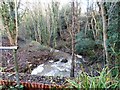
Whiteside Burn
At the point where it runs under the minor road from Edmondsley to Holmside.
Image: © Robert Graham
Taken: 28 Nov 2012
0.10 miles
6
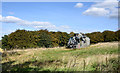
Aircraft wreckage in field at West Edmondsley
The aircraft, surely the remains of a helicopter - species unknown - is in a field close to the farm at West Edmondsley. Aerial views - OS Maps, Apple Maps - seem not to have the wreckage at the location recorded in the image but closer to the farm buildings they do show three other, rather more complete, helicopter bodies.
Image: © Trevor Littlewood
Taken: 17 Sep 2019
0.11 miles
8
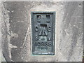
Ordnance Survey Flush Bracket 10938
This bracket can be found on the wall of a house at Holmside.
For more detail see : http://www.bench-marks.org.uk/bm2590
Image: © Peter Wood
Taken: 18 May 2012
0.15 miles
9
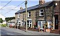
Cottages in Holmside
The small settlement of Holmside in the valley of the Whiteside Burn.
Image: © Trevor Littlewood
Taken: 17 Sep 2019
0.15 miles