IMAGES TAKEN NEAR TO
Bargate, DURHAM, DH7 0SR
Introduction
This page details the photographs taken nearby to Bargate, DH7 0SR by members of the Geograph project.
The Geograph project started in 2005 with the aim of publishing, organising and preserving representative images for every square kilometre of Great Britain, Ireland and the Isle of Man.

There are currently over 7.5m images from over14,400 individuals and you can help contribute to the project by visiting https://www.geograph.org.uk
Image Map
Images are licensed for reuse under creativecommons.org/licenses/by-sa/2.0
Notes
- Clicking on the map will re-center to the selected point.
- The higher the marker number, the further away the image location is from the centre of the postcode.
Image Listing (13 Images Found)
Images are licensed for reuse under creativecommons.org/licenses/by-sa/2.0
Image
Details
Distance
1
Bargate Cottage
Beside the B6301 south of Lanchester.
Image: © Robert Graham
Taken: 15 Aug 2012
0.01 miles
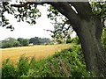
2
Farmland west of Bargate Bank
Climbing away from the Browney valley.
Image: © Christine Johnstone
Taken: 14 Apr 2012
0.07 miles
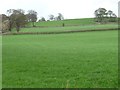
4
Farmland on the south bank of the Browney
The trees mark the line of the river, just west of Ford Bridge.
Image: © Christine Johnstone
Taken: 14 Apr 2012
0.10 miles
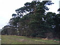
5
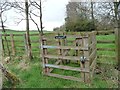
The Environment Agency's private gate
Giving access to the river gauging station near the weir on the Browney, just upstream of Ford Bridge.
Image: © Christine Johnstone
Taken: 14 Apr 2012
0.10 miles
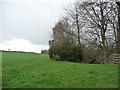
6
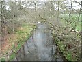
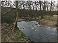
The River Browney
Upstream of Ford Bridge.
Image: © Christine Johnstone
Taken: 14 Apr 2012
0.11 miles
7
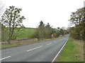
Ford Bridge
Bargate Bank [the B6301] crossing the River Browney on the way to Lanchester.
Image: © Christine Johnstone
Taken: 14 Apr 2012
0.12 miles
8
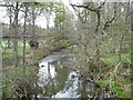
The River Browney
Downstream of Ford Bridge.
Image: © Christine Johnstone
Taken: 14 Apr 2012
0.12 miles
9
Dere Street Ford
This former ford at Ford Bridge on Dere Street is the likely crossing point for this Roman Road. The site was suggested to us by a dry stone walling contractor who was working nearby. He had observed the site as a boy when fishing the river.
Image: © John Walton
Taken: 26 Mar 2018
0.15 miles
10
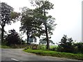
Entrance drive to Greenwell Farm
Off the B6301, south of Lanchester.
Image: © Robert Graham
Taken: 15 Aug 2012
0.18 miles