
IMAGES TAKEN NEAR TO
Lanchester, DURHAM, DH7 0RG
Introduction
This page details the photographs taken nearby to DH7 0RG by members of the Geograph project.
The Geograph project started in 2005 with the aim of publishing, organising and preserving representative images for every square kilometre of Great Britain, Ireland and the Isle of Man.

There are currently over 7.5m images from over14,400 individuals and you can help contribute to the project by visiting https://www.geograph.org.uk
Image Map
Images are licensed for reuse under creativecommons.org/licenses/by-sa/2.0
Notes
- Clicking on the map will re-center to the selected point.
- The higher the marker number, the further away the image location is from the centre of the postcode.
Image Listing (12 Images Found)
Images are licensed for reuse under creativecommons.org/licenses/by-sa/2.0
Image
Details
Distance
1
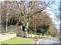
Colepike Hall boundary wall
The stone pillars once had iron railings between them, doubtless removed and melted down for the war effort.
Image: © David Collins
Taken: 17 Feb 2007
0.04 miles
2
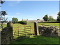
Old gate at Coalpike Hall Farm
This farm is beside the B6296 at the hamlet of Hollinside, west of Lanchester.
Image: © Robert Graham
Taken: 15 Jul 2015
0.04 miles
3
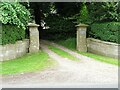
Entrance to Coalpike Hall
Some imposing stone entrance pillars for the hall off the B6296.
Image: © Robert Graham
Taken: 2 Jul 2021
0.09 miles
4
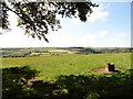
View south from Hollinside over the Browney valley
Looking across to the southern slope of the valley. The farm in the distance is Ragpath Side.
Image: © Robert Graham
Taken: 15 Jul 2015
0.16 miles
5
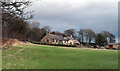
Buildings at Black House Farm
Black House Farm lies on the B6296 between the small village of Satley and the larger Lanchester. In recent years outbuildings at the farm have been converted to residential use.
Image: © Trevor Littlewood
Taken: 30 Nov 2011
0.16 miles
6
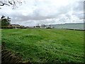
Buildings at Black House Farm
Seen across a meadow from the B6296.
Image: © Christine Johnstone
Taken: 14 Apr 2012
0.17 miles
7
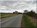
Looking towards Black House Farm
Viewed looking east from the road west of Coalpike Hall.
Image: © Robert Graham
Taken: 16 Apr 2012
0.19 miles
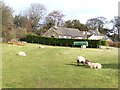
9

Looking along the B6296
View east along the road to Lanchester near Coalpike Hall. The view on the right is across the Browney valley.
Image: © Robert Graham
Taken: 10 Aug 2016
0.21 miles
10
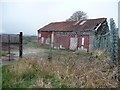
Still standing, just
Dilapidated shed by former quarry, south-west of Colepike Hall.
Image: © Christine Johnstone
Taken: 14 Apr 2012
0.22 miles