IMAGES TAKEN NEAR TO
Foxhills Crescent, DURHAM, DH7 0PP
Introduction
This page details the photographs taken nearby to Foxhills Crescent, DH7 0PP by members of the Geograph project.
The Geograph project started in 2005 with the aim of publishing, organising and preserving representative images for every square kilometre of Great Britain, Ireland and the Isle of Man.

There are currently over 7.5m images from over14,400 individuals and you can help contribute to the project by visiting https://www.geograph.org.uk
Image Map
Images are licensed for reuse under creativecommons.org/licenses/by-sa/2.0
Notes
- Clicking on the map will re-center to the selected point.
- The higher the marker number, the further away the image location is from the centre of the postcode.
Image Listing (26 Images Found)
Images are licensed for reuse under creativecommons.org/licenses/by-sa/2.0
Image
Details
Distance
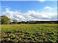
1
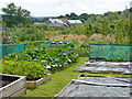
Margery Flats Lanchester
Viewed from the community allotments
Image: © Malcolm Coils
Taken: 30 Jul 2018
0.13 miles
2
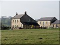
Margery Flatts farm
Neat little old farm, viewed from Newbiggin Lane to the north. Probably early C19 in origin.
Image: © Robert Graham
Taken: 10 Apr 2015
0.13 miles
3
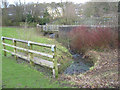
Footbridge over Alderdene Burn, Lanchester
Image: © Peter Robinson
Taken: 23 Feb 2011
0.15 miles
4
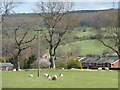
Trees on an old field boundary
With housing at the edge of Lanchester beyond.
Image: © Christine Johnstone
Taken: 14 Apr 2012
0.15 miles
5
Looking south from Newbiggin Lane
This country lane leads west from Lanchester village. At this point it crosses the line of Dere Street, the old Roman Road up to Hadrian's Wall, although there doesn't appear to be any sign of it on the ground.
Image: © Robert Graham
Taken: 15 Oct 2012
0.16 miles
6
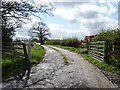
Track to Margery Flatts, off Newbiggin Lane
A place, not a person!
Image: © Christine Johnstone
Taken: 14 Apr 2012
0.16 miles
7
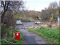
Carpark on Newbiggin Lane, Lanchester
The carpark is traversed by the Lanchester Valley Railway Path (part of National Cycle Network route 14) on the site of a demolished bridge on the line of the old railway from Lydgetts Junction to Durham.
Image: © Oliver Dixon
Taken: 13 Nov 2012
0.17 miles
8
One gone, one still standing
Felled tree under a darkening sky, north of Newbiggin Lane.
Image: © Christine Johnstone
Taken: 14 Apr 2012
0.17 miles
9
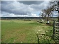
Farmland under a darkening sky
North of Newbiggin Lane.
Image: © Christine Johnstone
Taken: 14 Apr 2012
0.18 miles
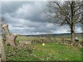
10
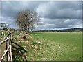
No more wall, just a fence
Sheep pasture field boundary, north of Newbiggin Lane.
Image: © Christine Johnstone
Taken: 14 Apr 2012
0.19 miles