
IMAGES TAKEN NEAR TO
Woodlands, DURHAM, DH7 0NS
Introduction
This page details the photographs taken nearby to Woodlands, DH7 0NS by members of the Geograph project.
The Geograph project started in 2005 with the aim of publishing, organising and preserving representative images for every square kilometre of Great Britain, Ireland and the Isle of Man.

There are currently over 7.5m images from over14,400 individuals and you can help contribute to the project by visiting https://www.geograph.org.uk
Image Map
Images are licensed for reuse under creativecommons.org/licenses/by-sa/2.0
Notes
- Clicking on the map will re-center to the selected point.
- The higher the marker number, the further away the image location is from the centre of the postcode.
Image Listing (78 Images Found)
Images are licensed for reuse under creativecommons.org/licenses/by-sa/2.0
Image
Details
Distance
1
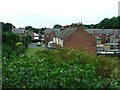
Lanchester
View south from the Lanchester Cycleway.
Image: © Mick Garratt
Taken: 23 Jul 2005
0.03 miles
2
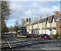
The X5 leaving Lanchester
The X5, Consett to Durham service leaving Lanchester along Durham Road. With the village church tower in the background.
Image: © Robert Graham
Taken: 21 Feb 2022
0.07 miles
3
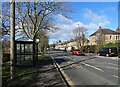
Bus stop on Durham Road
The main road into Lanchester from the east. The tower of the village church can be seen at the end of the street.
Image: © Robert Graham
Taken: 21 Feb 2022
0.08 miles
4
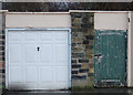
Two Doors in Lanchester
Seen in the car park at the back of the Kings Head pub I was attracted to these doors by their contrasting styles. Both open onto the pub car park and I suspect they hide a storage facility for the publican.
The green door is full of character; it is old and neglected but nevertheless its original purpose remains. The white door however is a mass-produced, powder coated newcomer of a type seen on housing estates throughout the land. A sort of up-and-over, in-your-face chav of a door. But each exist side by side quite happily guarding their secrets.
This supplemental shot aimed to add variety to a square already possessing several Geograph images.
Image: © michael ely
Taken: 15 Jan 2008
0.10 miles
5
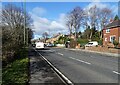
Looking along Durham Road Lanchester
View west along the A691 towards the village centre.
Image: © Robert Graham
Taken: 21 Feb 2022
0.11 miles
6
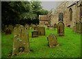
Gravestones, All Saints Church, Lanchester
Image: © Humphrey Bolton
Taken: 12 Sep 2023
0.12 miles
7
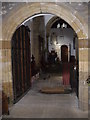
Entrance to the nave of the Parish Church, Lanchester
From the South Porch; via a stout oak and iron-clad lockable door, with hood moulding dating from the mid-12th century.
Image: © Stanley Howe
Taken: 21 Sep 2013
0.12 miles
8
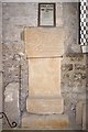
A Roman Altar (AD244) in Lanchester Church
One of a number of Roman Relicts found in Lanchester's Roman Fort at the end of the 19th century; and now resting in the south porch of the Parish Church of All Saints. A transcript of the inscription is in the frame above.
Image: © Stanley Howe
Taken: 21 Sep 2013
0.12 miles
9
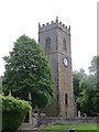
All Saints, Lanchester Parish Church
Viewed from the north-west.
Image: © Peter Wood
Taken: 31 May 2014
0.12 miles
10
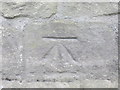
Ordnance Survey Cut Mark
This can be found on the wall of Lanchester Parish Church.
For more detail see : http://www.bench-marks.org.uk/bm57794
Image: © Peter Wood
Taken: 31 May 2014
0.12 miles