
IMAGES TAKEN NEAR TO
Pethside, DURHAM, DH7 0NA
Introduction
This page details the photographs taken nearby to Pethside, DH7 0NA by members of the Geograph project.
The Geograph project started in 2005 with the aim of publishing, organising and preserving representative images for every square kilometre of Great Britain, Ireland and the Isle of Man.

There are currently over 7.5m images from over14,400 individuals and you can help contribute to the project by visiting https://www.geograph.org.uk
Image Map
Images are licensed for reuse under creativecommons.org/licenses/by-sa/2.0
Notes
- Clicking on the map will re-center to the selected point.
- The higher the marker number, the further away the image location is from the centre of the postcode.
Image Listing (46 Images Found)
Images are licensed for reuse under creativecommons.org/licenses/by-sa/2.0
Image
Details
Distance
1
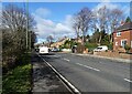
Looking along Durham Road Lanchester
View west along the A691 towards the village centre.
Image: © Robert Graham
Taken: 21 Feb 2022
0.11 miles
2
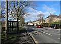
Bus stop on Durham Road
The main road into Lanchester from the east. The tower of the village church can be seen at the end of the street.
Image: © Robert Graham
Taken: 21 Feb 2022
0.13 miles
3
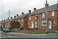
Red brick housing, Lanchester
Situated between Consett and Durham, this was formerly an agricultural village.
http://en.wikipedia.org/wiki/Lanchester,_County_Durham
Notable residents have included Canon William Greenwell (1820-1918), inventor of the popular 'Greenwell's Glory' fly-fishing fly. Not a lot of people know that.
Image: © Pauline E
Taken: 10 Oct 2009
0.13 miles
4
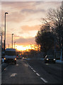
Lanchester sunrise
Marking the winter solstice and the first day of winter. Taken around 8.45.
Image: © Pauline E
Taken: 21 Dec 2009
0.15 miles
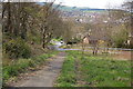
6
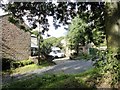
Houses on Peth Bank
This road leads east out of Lanchester village up to Burnhope.
Image: © Robert Graham
Taken: 16 Aug 2012
0.16 miles
7
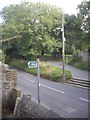
Public footpath across Peth Bank
And entering All Saints churchyard, Lanchester.
Image: © Stanley Howe
Taken: 21 Sep 2013
0.17 miles
8
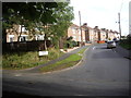
Deneside, Lanchester
Viewed across Peth Bank, from All Saints churchyard.
Image: © Stanley Howe
Taken: 21 Sep 2013
0.17 miles
9
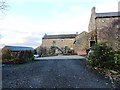
Peth House, Lanchester
This house dates back to medieval times.
Image: © Robert Graham
Taken: 28 Nov 2012
0.18 miles
10
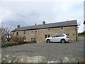
Former farmhouse at Peth House
This farm dates back a long way, possibly to the C18. This building was originally a linear style farmhouse with the byer for the animals in the right hand half of the building as seen here. It has now all been converted to residential.
Image: © Robert Graham
Taken: 11 Mar 2015
0.18 miles