
IMAGES TAKEN NEAR TO
Holmlea, DURHAM, DH7 0AU
Introduction
This page details the photographs taken nearby to Holmlea, DH7 0AU by members of the Geograph project.
The Geograph project started in 2005 with the aim of publishing, organising and preserving representative images for every square kilometre of Great Britain, Ireland and the Isle of Man.

There are currently over 7.5m images from over14,400 individuals and you can help contribute to the project by visiting https://www.geograph.org.uk
Image Map
Images are licensed for reuse under creativecommons.org/licenses/by-sa/2.0
Notes
- Clicking on the map will re-center to the selected point.
- The higher the marker number, the further away the image location is from the centre of the postcode.
Image Listing (9 Images Found)
Images are licensed for reuse under creativecommons.org/licenses/by-sa/2.0
Image
Details
Distance
1
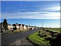
Houses at Fair View, Burnhope
This street of houses runs along Langley Lane, on the south side of the village. They are probably post war ex council houses. At 235m (over 750 feet), on the top of the valley, this must be a bleak spot in winter. Good views though.
Image: © Robert Graham
Taken: 8 Nov 2017
0.16 miles
2
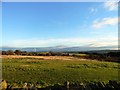
View SE from Burnhope
View from the west end of Holmside Lane , at the edge of the village. Typical of the fine views of the surrounding countryside here, at 258m - over 850 feet.
Image: © Robert Graham
Taken: 28 Nov 2012
0.16 miles
3
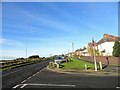
View along Langley Lane, Burnhope
This road runs along the southern side of the village. The houses are on Fair View. The former T V mast is prominent on the left.
Image: © Robert Graham
Taken: 8 Nov 2017
0.17 miles
4
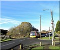
Local bus at Burnhope
This is the No 30 service which runs to the village from Stanley. This is at the junction of Langley Lane and Greenwood Avenue, up which the bus will turn.
Image: © Robert Graham
Taken: 8 Nov 2017
0.18 miles
5

Grazing sheep at Burnhope
In a field south of Langley Lane.
Image: © Robert Graham
Taken: 8 Nov 2017
0.19 miles
6
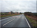
Langley Lane
Heading south east towards Durham.
Image: © JThomas
Taken: 2 Apr 2016
0.21 miles
7

The main road through Burnhope
Looking southwest down Holmside Lane in this old former mining village.
Image: © Robert Graham
Taken: 28 Nov 2012
0.23 miles
8
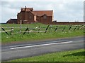
The first and last house in Burnhope
Burnhope was categorised as a "category D village" by Durham County Council. With the decline of coal-mining locally, 114 villages were classified in this way in 1951, and another seven in 1964. They were left to wither and die, without economic assistance or development. The policy ended in 1977, but many still have an old fashioned air, contrasting with newer areas of commuter housing.
Image: © Christine Johnstone
Taken: 14 Apr 2012
0.23 miles
9

Grazing off Langley Lane
Looking towards the radio mast.
Image: © JThomas
Taken: 2 Apr 2016
0.24 miles