
IMAGES TAKEN NEAR TO
Aged Miners Homes, DURHAM, DH6 4PF
Introduction
This page details the photographs taken nearby to Aged Miners Homes, DH6 4PF by members of the Geograph project.
The Geograph project started in 2005 with the aim of publishing, organising and preserving representative images for every square kilometre of Great Britain, Ireland and the Isle of Man.

There are currently over 7.5m images from over14,400 individuals and you can help contribute to the project by visiting https://www.geograph.org.uk
Image Map
Images are licensed for reuse under creativecommons.org/licenses/by-sa/2.0
Notes
- Clicking on the map will re-center to the selected point.
- The higher the marker number, the further away the image location is from the centre of the postcode.
Image Listing (10 Images Found)
Images are licensed for reuse under creativecommons.org/licenses/by-sa/2.0
Image
Details
Distance
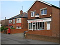
2

George VI postbox on Front Street, Kelloe
Postbox No. DH6 330.
Image: © JThomas
Taken: 9 May 2025
0.12 miles
3
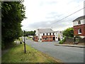
The Davy Lamp at Kelloe
A pub of this name is shown on the first Ordnance Survey map of the 1860's, but this particular building looks much later than that.
Image: © Robert Graham
Taken: 19 Jun 2013
0.12 miles
4
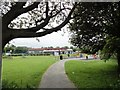
Kelloe Primary School
The village school viewed from the south, on the main road through the village.
Image: © Robert Graham
Taken: 19 Jun 2013
0.12 miles
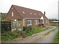
6
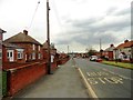
Looking east along the main street in Kelloe
An ex mining village south of Durham City. This part is modern, but Kelloe has a long history dating back to the middle ages.
Image: © Robert Graham
Taken: 19 Jun 2013
0.17 miles
8
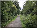
The Kelloe Way
The former mineral railway branch line to East Hetton (Kelloe) Colliery, now a recreational route named the Kelloe Way. View looking West from the edge of Kelloe with barriers marking the point where a minor road to a sewerage plant crosses the Kelloe Way.
Image: © David Robinson
Taken: 17 Jul 2019
0.20 miles
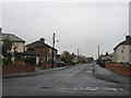
10
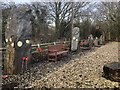
Artwork beside the former railway to East Hetton Colliery
This area of ground beside the former mineral railway serving East Hetton (Kelloe) Colliery is dedicated to those who lost their lives winning coal during the mine's working life (1836 - 1983). The stones represent miners coming to and from the mine which is depicted by the steel arch.
Image: © David Robinson
Taken: 21 Dec 2018
0.24 miles