IMAGES TAKEN NEAR TO
Westgarth Grove, DURHAM, DH6 2YB
Introduction
This page details the photographs taken nearby to Westgarth Grove, DH6 2YB by members of the Geograph project.
The Geograph project started in 2005 with the aim of publishing, organising and preserving representative images for every square kilometre of Great Britain, Ireland and the Isle of Man.

There are currently over 7.5m images from over14,400 individuals and you can help contribute to the project by visiting https://www.geograph.org.uk
Image Map
Images are licensed for reuse under creativecommons.org/licenses/by-sa/2.0
Notes
- Clicking on the map will re-center to the selected point.
- The higher the marker number, the further away the image location is from the centre of the postcode.
Image Listing (23 Images Found)
Images are licensed for reuse under creativecommons.org/licenses/by-sa/2.0
Image
Details
Distance
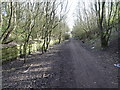
1
Station Road, Shotton Colliery
Where the road passes over the Haswell to Hart Cycleway on the disused railway
Image: © Oliver Dixon
Taken: 10 Apr 2006
0.03 miles
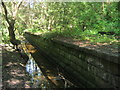
3
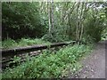
Shotton Bridge Station
1832-1952 on the Hartlepool Railway and Docks Railway. It is in a deep cutting.
Image: © Richard Webb
Taken: 9 Aug 2016
0.10 miles
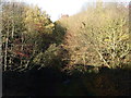
4
Shotton Bridge railway station (site), County Durham
Opened in 1863 by the North Eastern Railway on the line from Sunderland to Hartlepool via Haswell, this station closed to passengers in 1952.
View south east towards Thornley and Hartlepool, also Stockton. The south-bound platform was still extant to the left, when this image was taken. The platform buildings, northbound platform (to the right) and street-level building on the bridge had all long-since disappeared, and the track-bed had become a public footpath.
Image: © Nigel Thompson
Taken: 19 Mar 2020
0.11 miles
6
Remains of platform on eastern side of site of Station Bridge Station
Image: © Peter Robinson
Taken: 2 Sep 2012
0.11 miles
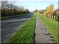
7
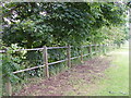
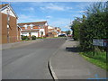
A line of trees marks the boundary between the road and the farmland
Image: © Carol Rose
Taken: 23 Jun 2007
0.12 miles
9
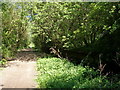
Site of railway station
On the Haswell to Hart Countryside walkway. The old platform is hiding in the bushes to the right
Image: © John Slater
Taken: 27 May 2012
0.12 miles