IMAGES TAKEN NEAR TO
Pittington Crossing, DURHAM, DH6 1BL
Introduction
This page details the photographs taken nearby to Pittington Crossing, DH6 1BL by members of the Geograph project.
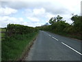
The Geograph project started in 2005 with the aim of publishing, organising and preserving representative images for every square kilometre of Great Britain, Ireland and the Isle of Man.

There are currently over 7.5m images from over14,400 individuals and you can help contribute to the project by visiting https://www.geograph.org.uk
Image Map
Images are licensed for reuse under creativecommons.org/licenses/by-sa/2.0
Notes
- Clicking on the map will re-center to the selected point.
- The higher the marker number, the further away the image location is from the centre of the postcode.
Image Listing (19 Images Found)
Images are licensed for reuse under creativecommons.org/licenses/by-sa/2.0
Image
Details
Distance
1
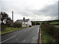
Cottages on Moorsley Road
Just to the North of the village of Low Pittington.
Image: © Robert Graham
Taken: 11 Apr 2012
0.01 miles
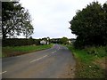
3
Moorsley Road joining Pittington Road
Image: © Peter Robinson
Taken: 10 Feb 2013
0.07 miles
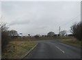
4
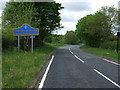
Entering County Durham
Heading south west on Moorsley Road.
Image: © JThomas
Taken: 28 May 2015
0.09 miles
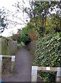
6
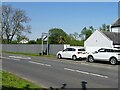
Pittington railway station (site), County Durham
Opened in 1837 by the Durham& Sunderland Railway, eventually part of the North Eastern Railway, this station closed to passengers in 1954.
View north east from the former level crossing diagonally across the road towards Hetton and Sunderland. The railway line went to approximately the left hand side of the National speed limit sign. The single platform was just to the right of this line, beyond where the fence now is. No trace apparently remains.
For more information, see http://www.disused-stations.org.uk/p/pittington/index.shtml
Image: © Nigel Thompson
Taken: 29 May 2021
0.16 miles
7
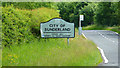
City of Sunderland Sign, Moorsley Road
Image: © Richard Cooke
Taken: 15 Jun 2010
0.16 miles
9
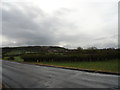
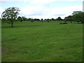
Looking South from Moorsley Road
View from this country lane to the East of Durham city. The village of Low Pittington in the distance with a nice view of Pittington Hill beyond.
Image: © Robert Graham
Taken: 11 Apr 2012
0.17 miles