IMAGES TAKEN NEAR TO
Bradley Avenue, HOUGHTON LE SPRING, DH5 8JZ
Introduction
This page details the photographs taken nearby to Bradley Avenue, DH5 8JZ by members of the Geograph project.
The Geograph project started in 2005 with the aim of publishing, organising and preserving representative images for every square kilometre of Great Britain, Ireland and the Isle of Man.

There are currently over 7.5m images from over14,400 individuals and you can help contribute to the project by visiting https://www.geograph.org.uk
Image Map (27 Images)


Getting Data...Please wait
Leaflet Map data © OpenStreetMap
Images are licensed for reuse under creativecommons.org/licenses/by-sa/2.0
Notes
- Clicking on the map will re-center to the selected point.
- The higher the marker number, the further away the image location is from the centre of the postcode.
Image Listing (27 Images Found)
Images are licensed for reuse under creativecommons.org/licenses/by-sa/2.0
Image
Details
Distance
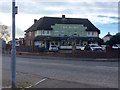
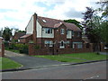
1
Gillas Lane West in Houghton-le-Spring
Image: © Peter Robinson
Taken: 10 Feb 2013
0.09 miles
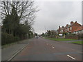
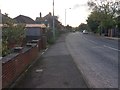
2
Gillas Lane West, Houghton-le-Spring
On the B1260 Rainton Bridge to Houghton New Town road.
Image: © Oliver Dixon
Taken: 16 Jan 2007
0.09 miles
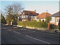
4
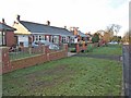
Bungalows on Gillas Lane West, Houghton-le-Spring
On the B1404 Seaham to Rainton Bridge road.
Image: © Oliver Dixon
Taken: 16 Jan 2007
0.10 miles
5
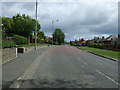
Gillas Lane West, Rainton Bridge
Heading east.
Image: © JThomas
Taken: 28 May 2015
0.10 miles
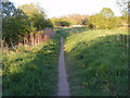
6
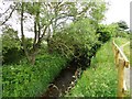
Hainton Burn
This little stream runs through Hetton Bogs Nature Reserve.
Image: © Robert Graham
Taken: 3 Jul 2013
0.12 miles
8
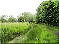
Overgrown pond
In Hetton Bogs Nature Reserve. This runs along the Hainton and Hetton Burns.
Image: © Robert Graham
Taken: 3 Jul 2013
0.16 miles