IMAGES TAKEN NEAR TO
High Moorsley, Hetton-le-Hole, HOUGHTON LE SPRING, DH5 0RJ
Introduction
This page details the photographs taken nearby to DH5 0RJ by members of the Geograph project.
The Geograph project started in 2005 with the aim of publishing, organising and preserving representative images for every square kilometre of Great Britain, Ireland and the Isle of Man.

There are currently over 7.5m images from over14,400 individuals and you can help contribute to the project by visiting https://www.geograph.org.uk
Image Map
Images are licensed for reuse under creativecommons.org/licenses/by-sa/2.0
Notes
- Clicking on the map will re-center to the selected point.
- The higher the marker number, the further away the image location is from the centre of the postcode.
Image Listing (11 Images Found)
Images are licensed for reuse under creativecommons.org/licenses/by-sa/2.0
Image
Details
Distance
1
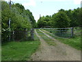
Farm track and footpath, High Moorsley
Off Moorsley Road.
Image: © JThomas
Taken: 28 May 2015
0.03 miles
2
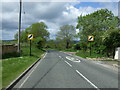
Leaving High Moorsley
Heading west on Moorsley Road.
Image: © JThomas
Taken: 28 May 2015
0.07 miles
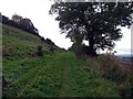
5
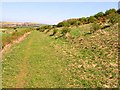
Footpath on old railway leading to High Moorsley quarry
County Durham is riddled with old railway lines which mostly carried coal and quarry traffic. This footpath follows a long-abandoned railway branch line to High Moorsley Quarry Image Further down the slope to the left was another line, which linked the existing goods line at Sherburn to another, abandoned, line at Murton.
Image: © Oliver Dixon
Taken: 5 May 2006
0.16 miles
6
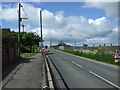
Roadworks on Moorsley Road
Looking south west.
Image: © JThomas
Taken: 28 May 2015
0.17 miles
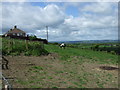
7
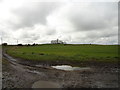
Farm track near High Moorsley Farm
Rather muddy because of the recent wet weather.
Image: © Robert Graham
Taken: 11 Apr 2012
0.18 miles
9
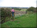
Footpath junction
Junction of the Great Northern Forest Trail and the Coalfield Way.
Image: © Roger Smith
Taken: 12 Oct 2008
0.18 miles
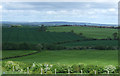
10
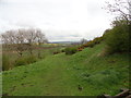
Hillside below High Moorsley
The path forms the Heritage Trail.
Image: © Robert Graham
Taken: 11 Apr 2012
0.20 miles