IMAGES TAKEN NEAR TO
Langhope, HOUGHTON LE SPRING, DH4 7PN
Introduction
This page details the photographs taken nearby to Langhope, DH4 7PN by members of the Geograph project.
The Geograph project started in 2005 with the aim of publishing, organising and preserving representative images for every square kilometre of Great Britain, Ireland and the Isle of Man.

There are currently over 7.5m images from over14,400 individuals and you can help contribute to the project by visiting https://www.geograph.org.uk
Image Map
Images are licensed for reuse under creativecommons.org/licenses/by-sa/2.0
Notes
- Clicking on the map will re-center to the selected point.
- The higher the marker number, the further away the image location is from the centre of the postcode.
Image Listing (16 Images Found)
Images are licensed for reuse under creativecommons.org/licenses/by-sa/2.0
Image
Details
Distance
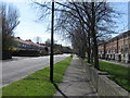
3
Station Road, Penshaw
New Bellway Homes site on the left
Image: © Alex McGregor
Taken: 22 Apr 2010
0.16 miles
4
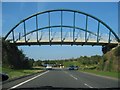
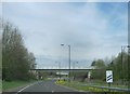
Bridge on Approach to Biddick Hall roundabout
Travelling to Washington.
Image: © Dianne Snowdon
Taken: 3 Sep 2005
0.17 miles
5
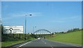
The A182 on the outskirts of Shiney Row leading to the roundabout junction with the A183
Image: © Peter Robinson
Taken: 6 May 2013
0.18 miles
6
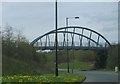
Foot Bridge Near Biddick Hall Roundabout
Approaching the Washington Highway.
Image: © Dianne Snowdon
Taken: 3 Sep 2005
0.19 miles
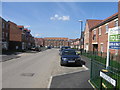
8
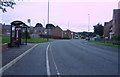
Bus stop and shelter on Station Road, Penshaw
Image: © JThomas
Taken: 18 Aug 2018
0.20 miles
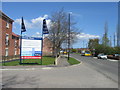
9
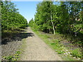
Penshaw 2nd station (site), Tyne & Wear
Opened in 1881 by the North Eastern Railway on the line from Darlington to Newcastle via Washington, this station replaced an earlier one some 200m north of here. After it suffered serious fire damage in 1913, it was completely rebuilt as an island platform on the same site. It closed to passengers in 1964. The track through here was lifted in 2012.
View north towards Washington and Newcastle. No trace of either station apparently remains.
For more information, see http://www.disused-stations.org.uk/p/penshaw_second/index.shtml
Image: © Nigel Thompson
Taken: 29 May 2021
0.20 miles
10
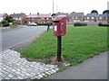
Elizabeth II postbox on Station Road, Penshaw
Image: © JThomas
Taken: 18 Aug 2018
0.21 miles