
IMAGES TAKEN NEAR TO
Penshaw, HOUGHTON LE SPRING, DH4 7NG
Introduction
This page details the photographs taken nearby to DH4 7NG by members of the Geograph project.
The Geograph project started in 2005 with the aim of publishing, organising and preserving representative images for every square kilometre of Great Britain, Ireland and the Isle of Man.

There are currently over 7.5m images from over14,400 individuals and you can help contribute to the project by visiting https://www.geograph.org.uk
Image Map
Images are licensed for reuse under creativecommons.org/licenses/by-sa/2.0
Notes
- Clicking on the map will re-center to the selected point.
- The higher the marker number, the further away the image location is from the centre of the postcode.
Image Listing (11 Images Found)
Images are licensed for reuse under creativecommons.org/licenses/by-sa/2.0
Image
Details
Distance
1
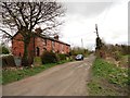
Railway Cottages, Penshaw
Victorian terrace beside what used to be the main east line until 1872. Located just north of Penshaw village.
Image: © Robert Graham
Taken: 24 Apr 2013
0.02 miles
2
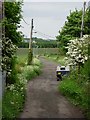
Unadopted road to Low Lambton Farm (old wagonway)
This was in the 19th century the route of a wagonway to Low Lambton Staithes. Now used for access to the farm and by walkers.
Image: © Brian Abbott
Taken: 27 May 2006
0.03 miles
3
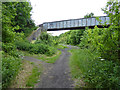
Footbridge over the Leamside Line
The Leamside Line is the mothballed railway which runs parallel to the East Coast Main Line between Ferryhill and Newcastle. The trackbed and ballast has been preserved against possible re-opening although the track has been removed (some of it stolen as on this section).
Image: © Oliver Dixon
Taken: 19 Jun 2015
0.06 miles
4
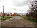
Coxgreen Road, Penshaw
View of the north east corner of Penshaw village.
Image: © Robert Graham
Taken: 24 Apr 2013
0.10 miles
5
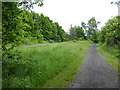
Junction on the Leamside Line
The Leamside Line which can be seen to the left is the mothballed railway which runs parallel to the East Coast Main Line between Ferryhill and Newcastle. The trackbed and ballast has been preserved against possible re-opening although the track has been removed (some of it stolen as on this section).
To the right is the line of the old branch line to Sunderland.
Image: © Oliver Dixon
Taken: 19 Jun 2015
0.10 miles
6
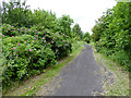
Wild roses beside the old railway line
A path follows the line of the old railway which linked Penshaw on the Leamside Line with Sunderland. This view is just to the north of the junction.
Image: © Oliver Dixon
Taken: 19 Jun 2015
0.13 miles
7
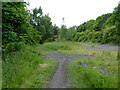
Leamside Line at Penshaw
The Leamside Line is the mothballed railway which runs parallel to the East Coast Main Line between Ferryhill and Newcastle. The trackbed and ballast has been preserved against possible re-opening although the track has been removed (some of it stolen as on this section).
Image: © Oliver Dixon
Taken: 19 Jun 2015
0.14 miles
8
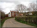
Low Lambton Farm
Victorian farm at Penshaw.
Image: © Robert Graham
Taken: 24 Apr 2013
0.17 miles
9
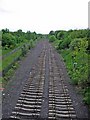
A disused railway line with a story ...
This railway line, (the Leamside Line) running from Wardley in the North to join the main London - Scotland line south of Durham, was finally closed in the early 1990s but has largely been left 'as was'.
In 2003 an enterprising criminal took up about 2 miles of track with the intention of selling it (he was caught, but by then the track was gone). The results of his actions are seen in this picture.
Further info:
http://news.bbc.co.uk/1/hi/england/3044669.stm
Image: © Brian Abbott
Taken: 27 May 2006
0.19 miles
10
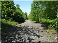
Penshaw 1st station (site), Tyne & Wear
Opened in 1841 by the Durham Junction Railway on the line from Washington to Rainton Meadows, local services initially ran to Gateshead. From 1844, the Newcastle and Darlington Junction Railway via Leamside connected to this line just south of Fencehouses, and so it became part of the East Coast Main Line from London to Newcastle (until 1872 when the current main line via Durham was opened).
View north towards Washington and Newcastle. The station initially had two parallel platforms north east of station road. The station, which was also known as "Pensher" at this time (and "Painshaw" on OS maps) was relocated to 200m behind the camera position in 1881. The track through here was in situ until 2012. No trace of either station apparently remains.
For more information, see http://www.disused-stations.org.uk/p/penshaw_first/index.shtml
Image: © Nigel Thompson
Taken: 29 May 2021
0.23 miles