
IMAGES TAKEN NEAR TO
Burns Close, HOUGHTON LE SPRING, DH4 6SY
Introduction
This page details the photographs taken nearby to Burns Close, DH4 6SY by members of the Geograph project.
The Geograph project started in 2005 with the aim of publishing, organising and preserving representative images for every square kilometre of Great Britain, Ireland and the Isle of Man.

There are currently over 7.5m images from over14,400 individuals and you can help contribute to the project by visiting https://www.geograph.org.uk
Image Map
Images are licensed for reuse under creativecommons.org/licenses/by-sa/2.0
Notes
- Clicking on the map will re-center to the selected point.
- The higher the marker number, the further away the image location is from the centre of the postcode.
Image Listing (35 Images Found)
Images are licensed for reuse under creativecommons.org/licenses/by-sa/2.0
Image
Details
Distance
1
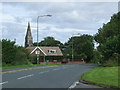
West Rainton, County Durham
The road used to be the main road linking Durham with Sunderland. There is now a by-pass which has removed much of the traffic from this road.
Image: © Malc McDonald
Taken: 28 Aug 2011
0.05 miles
2

Steps for public footpath to reach the A690
Image: © Peter Robinson
Taken: 10 Feb 2013
0.12 miles

4
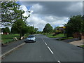
Chantry Place, Rainton Gate
Heading north east.
Image: © JThomas
Taken: 28 May 2015
0.15 miles
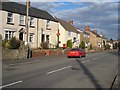
6
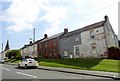
South Street, West Rainton
View along the village main street, looking east. The tall spire of St Mary's church visible on the right.
Image: © Robert Graham
Taken: 20 Apr 2016
0.17 miles
8

Farm track near West Rainton
A track leading to Field House Farm, near West Rainton in County Durham.
Image: © Malc McDonald
Taken: 28 Aug 2011
0.18 miles
9

Rainton Lodge in North Street West Rainton
Image: © Peter Robinson
Taken: 10 Feb 2013
0.19 miles
10

Church at West Rainton
The Church of St Mary the Virgin in West Rainton is set attractively in an area of parkland rather than amid the gravestones of a graveyard. There are old graves, out of view to the right of the image but the current burial ground of the village seems to be a cemetery across a road from the church.
Image: © Trevor Littlewood
Taken: 18 Mar 2017
0.20 miles