IMAGES TAKEN NEAR TO
Leamside, HOUGHTON LE SPRING, DH4 6QJ
Introduction
This page details the photographs taken nearby to DH4 6QJ by members of the Geograph project.
The Geograph project started in 2005 with the aim of publishing, organising and preserving representative images for every square kilometre of Great Britain, Ireland and the Isle of Man.

There are currently over 7.5m images from over14,400 individuals and you can help contribute to the project by visiting https://www.geograph.org.uk
Image Map
Images are licensed for reuse under creativecommons.org/licenses/by-sa/2.0
Notes
- Clicking on the map will re-center to the selected point.
- The higher the marker number, the further away the image location is from the centre of the postcode.
Image Listing (16 Images Found)
Images are licensed for reuse under creativecommons.org/licenses/by-sa/2.0
Image
Details
Distance
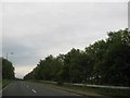
1

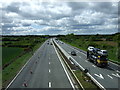
West Rainton and Leamside : A1(M)
Looking north on the A1(M).
Image: © Lewis Clarke
Taken: 21 Sep 2020
0.08 miles
2
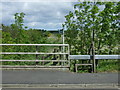
Footpath off Cocken Road
Heads north beside the A1(M) Motorway.
Image: © JThomas
Taken: 28 May 2015
0.13 miles
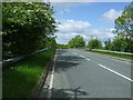
3
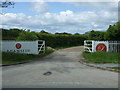
Heading west away from Leamside
North of Raintonpark Wood in Tyne and Wear.
Image: © James Denham
Taken: 27 Jun 2014
0.13 miles
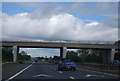


9
The A1(M) southbound
Looking south from the bridge on Cocken Road.
Image: © JThomas
Taken: 28 May 2015
0.20 miles
