IMAGES TAKEN NEAR TO
Chilton Moor, HOUGHTON LE SPRING, DH4 6QD
Introduction
This page details the photographs taken nearby to DH4 6QD by members of the Geograph project.
The Geograph project started in 2005 with the aim of publishing, organising and preserving representative images for every square kilometre of Great Britain, Ireland and the Isle of Man.

There are currently over 7.5m images from over14,400 individuals and you can help contribute to the project by visiting https://www.geograph.org.uk
Image Map
Images are licensed for reuse under creativecommons.org/licenses/by-sa/2.0
Notes
- Clicking on the map will re-center to the selected point.
- The higher the marker number, the further away the image location is from the centre of the postcode.
Image Listing (11 Images Found)
Images are licensed for reuse under creativecommons.org/licenses/by-sa/2.0
Image
Details
Distance
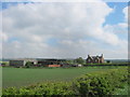
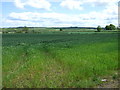
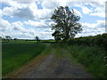
4
Farmland towards the A1(M)
West of Pithouse Lane.
Image: © JThomas
Taken: 28 May 2015
0.20 miles
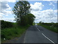
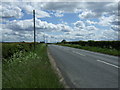
5
Black Boy Road near Houghton-le-Spring
Black Boy Road, at its junction with Pithouse Lane.
Image: © Malc McDonald
Taken: 29 Aug 2011
0.21 miles
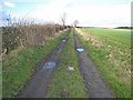
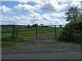
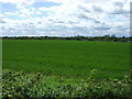
7
Farm track off Black Boy Road
Looking south.
Image: © JThomas
Taken: 28 May 2015
0.22 miles