
IMAGES TAKEN NEAR TO
Maiden Law, HOUGHTON LE SPRING, DH4 6NF
Introduction
This page details the photographs taken nearby to Maiden Law, DH4 6NF by members of the Geograph project.
The Geograph project started in 2005 with the aim of publishing, organising and preserving representative images for every square kilometre of Great Britain, Ireland and the Isle of Man.

There are currently over 7.5m images from over14,400 individuals and you can help contribute to the project by visiting https://www.geograph.org.uk
Image Map
Images are licensed for reuse under creativecommons.org/licenses/by-sa/2.0
Notes
- Clicking on the map will re-center to the selected point.
- The higher the marker number, the further away the image location is from the centre of the postcode.
Image Listing (13 Images Found)
Images are licensed for reuse under creativecommons.org/licenses/by-sa/2.0
Image
Details
Distance
1
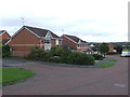
Atherton Drive, near Houghton-le-Spring
Modern housing on Atherton Drive, in Chilton Moor.
Image: © Malc McDonald
Taken: 29 Aug 2011
0.04 miles

3
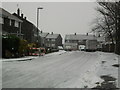
Let it Snow !!
Snowy scene in St Andrews Houghton-le-Spring
Image: © Gary Fellows
Taken: 25 Jan 2013
0.09 miles
6
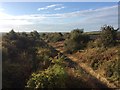
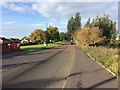
Leamside Line
Following the path of the old leamside line at Black Boy Road
Image: © Gary Fellows
Taken: 30 Sep 2017
0.16 miles
7
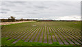
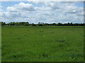
Turf field
The land is owned or at least managed by a company, Durham Turf; the nature of the turf harvesting is obvious in the image which was recorded along Black Boy Road, looking near to south.
To the left is an old railway route, the Leamside Line.
Image: © Trevor Littlewood
Taken: 18 Mar 2017
0.18 miles

10
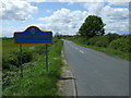
Entering County Durham
Heading west on Black Boy Road.
Image: © JThomas
Taken: 28 May 2015
0.20 miles