IMAGES TAKEN NEAR TO
Abbey Drive, HOUGHTON LE SPRING, DH4 5LA
Introduction
This page details the photographs taken nearby to Abbey Drive, DH4 5LA by members of the Geograph project.
The Geograph project started in 2005 with the aim of publishing, organising and preserving representative images for every square kilometre of Great Britain, Ireland and the Isle of Man.

There are currently over 7.5m images from over14,400 individuals and you can help contribute to the project by visiting https://www.geograph.org.uk
Image Map
Images are licensed for reuse under creativecommons.org/licenses/by-sa/2.0
Notes
- Clicking on the map will re-center to the selected point.
- The higher the marker number, the further away the image location is from the centre of the postcode.
Image Listing (15 Images Found)
Images are licensed for reuse under creativecommons.org/licenses/by-sa/2.0
Image
Details
Distance
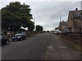
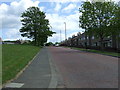
2
Otterburn Crescent, Houghton-le-Spring
Image: © Malc McDonald
Taken: 29 Aug 2011
0.13 miles
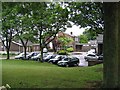
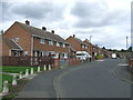
8
Thorneyburn Close, Houghton-le-Spring
A development of semi-detached houses in Houghton-le-Spring
Image: © Malc McDonald
Taken: 29 Aug 2011
0.21 miles
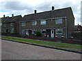
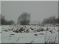
9
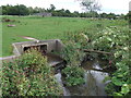
Moors Burn, near Houghton-le-Spring
Moors Burn is a tributary of the River Wear.
Image: © Malc McDonald
Taken: 29 Aug 2011
0.22 miles
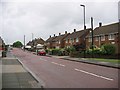
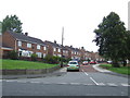
10
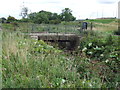
Bridge over Moors Burn, Houghton-le-Spring
A bridge carrying a footpath over Moors Burn, between Houghton-le-Spring and Fencehouses. Moors Burn is a tributary of the River Wear.
Image: © Malc McDonald
Taken: 29 Aug 2011
0.22 miles