IMAGES TAKEN NEAR TO
Brinkburn Crescent, HOUGHTON LE SPRING, DH4 5HE
Introduction
This page details the photographs taken nearby to Brinkburn Crescent, DH4 5HE by members of the Geograph project.
The Geograph project started in 2005 with the aim of publishing, organising and preserving representative images for every square kilometre of Great Britain, Ireland and the Isle of Man.

There are currently over 7.5m images from over14,400 individuals and you can help contribute to the project by visiting https://www.geograph.org.uk
Image Map
Images are licensed for reuse under creativecommons.org/licenses/by-sa/2.0
Notes
- Clicking on the map will re-center to the selected point.
- The higher the marker number, the further away the image location is from the centre of the postcode.
Image Listing (10 Images Found)
Images are licensed for reuse under creativecommons.org/licenses/by-sa/2.0
Image
Details
Distance
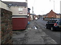
1
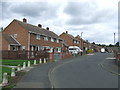
Thorneyburn Close, Houghton-le-Spring
A development of semi-detached houses in Houghton-le-Spring
Image: © Malc McDonald
Taken: 29 Aug 2011
0.04 miles
3
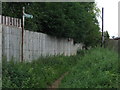
Public footpath, Houghton-le-Spring
A public footpath in Houghton-le-Spring.
Image: © Malc McDonald
Taken: 29 Aug 2011
0.07 miles
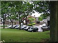
4
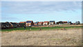
Rough Grass west of Grasswell
Grasswell is a small village in County Durham close to Houghton-Le-Spring. Burnside is another Durham village in the same area - the houses across the grass will either be there or possibly in Sunniside.
Image: © Trevor Littlewood
Taken: 20 Feb 2018
0.15 miles
5
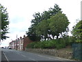
Blind Lane, Houghton-le-Spring
The low stone wall marks the site of a bridge which carried a railway into Houghton Quarry.
Image: © Malc McDonald
Taken: 29 Aug 2011
0.17 miles
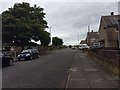
6
Otterburn Crescent, Houghton-le-Spring
Image: © Malc McDonald
Taken: 29 Aug 2011
0.19 miles
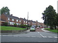
7
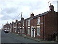
Graswell Terrace, Houghton-le-Spring
A terrace of cottages in Houghton-le-Spring.
Image: © Malc McDonald
Taken: 29 Aug 2011
0.19 miles
8
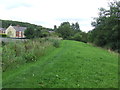
Site of colliery railway, Houghton-le-Spring
This grassy bank once carried a railway which served Houghton Quarry.
Image: © Malc McDonald
Taken: 29 Aug 2011
0.20 miles