IMAGES TAKEN NEAR TO
Trinity Park, HOUGHTON LE SPRING, DH4 4UL
Introduction
This page details the photographs taken nearby to Trinity Park, DH4 4UL by members of the Geograph project.
The Geograph project started in 2005 with the aim of publishing, organising and preserving representative images for every square kilometre of Great Britain, Ireland and the Isle of Man.

There are currently over 7.5m images from over14,400 individuals and you can help contribute to the project by visiting https://www.geograph.org.uk
Image Map
Images are licensed for reuse under creativecommons.org/licenses/by-sa/2.0
Notes
- Clicking on the map will re-center to the selected point.
- The higher the marker number, the further away the image location is from the centre of the postcode.
Image Listing (6 Images Found)
Images are licensed for reuse under creativecommons.org/licenses/by-sa/2.0
Image
Details
Distance
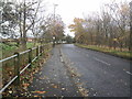
2
Public Footpath
Leads you to Chester Road from Success Road
Image: © Gary Fellows
Taken: 18 Nov 2013
0.06 miles
3

I can see a Rainbow!
In the skies above Success Road
Image: © Gary Fellows
Taken: 30 Jan 2013
0.06 miles
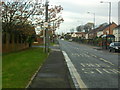
4
Bradwell Way
Looking up toward Bradwell Way from junction with Success Road
Image: © Gary Fellows
Taken: 18 Nov 2013
0.09 miles
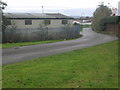
5
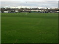
Football Pitch
In field just off Success Road
Image: © Gary Fellows
Taken: 18 Nov 2013
0.13 miles