IMAGES TAKEN NEAR TO
Foundry Close, HOUGHTON LE SPRING, DH4 4AX
Introduction
This page details the photographs taken nearby to Foundry Close, DH4 4AX by members of the Geograph project.
The Geograph project started in 2005 with the aim of publishing, organising and preserving representative images for every square kilometre of Great Britain, Ireland and the Isle of Man.

There are currently over 7.5m images from over14,400 individuals and you can help contribute to the project by visiting https://www.geograph.org.uk
Image Map
Images are licensed for reuse under creativecommons.org/licenses/by-sa/2.0
Notes
- Clicking on the map will re-center to the selected point.
- The higher the marker number, the further away the image location is from the centre of the postcode.
Image Listing (11 Images Found)
Images are licensed for reuse under creativecommons.org/licenses/by-sa/2.0
Image
Details
Distance
1
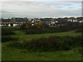
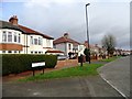
Housing Ross Lea
Ross Lea houses viewed from Success Road
Image: © Gary Fellows
Taken: 18 Nov 2013
0.10 miles
2
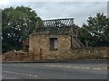
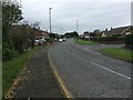
Dilapidated Building
At the Junction of Success and Golf Course Roads
Image: © Gary Fellows
Taken: 1 Oct 2017
0.12 miles
3
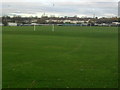
Football Pitch
In field just off Success Road
Image: © Gary Fellows
Taken: 18 Nov 2013
0.16 miles
4
Road Junction
Junction between Golf Course Road and Blind Lane
Image: © Gary Fellows
Taken: 25 Jan 2013
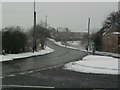
0.19 miles
7
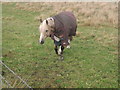
A four legged friend
Horse well wrapped up in the freezing weather
Image: © Gary Fellows
Taken: 18 Nov 2013
0.23 miles
8
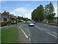
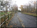
Chester Road, Shiney Row
This is Hindson's Crescent North, running along Chester Road, the main road through the village.
Image: © Robert Graham
Taken: 24 Apr 2013
0.23 miles
9
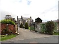
Boundary House, Shiney Row
This large old house is located on Chester Road on the east side of the village. It obviously gives its name to the modern district of Boundary Houses. I don't know its age but it is shown on the Old Series Ordnance Survey map of 1862, and looks to be possibly late 18th century.
Image: © Robert Graham
Taken: 24 Apr 2013
0.23 miles