
IMAGES TAKEN NEAR TO
Cherry Banks, CHESTER LE STREET, DH3 4AX
Introduction
This page details the photographs taken nearby to Cherry Banks, DH3 4AX by members of the Geograph project.
The Geograph project started in 2005 with the aim of publishing, organising and preserving representative images for every square kilometre of Great Britain, Ireland and the Isle of Man.

There are currently over 7.5m images from over14,400 individuals and you can help contribute to the project by visiting https://www.geograph.org.uk
Image Map
Images are licensed for reuse under creativecommons.org/licenses/by-sa/2.0
Notes
- Clicking on the map will re-center to the selected point.
- The higher the marker number, the further away the image location is from the centre of the postcode.
Image Listing (18 Images Found)
Images are licensed for reuse under creativecommons.org/licenses/by-sa/2.0
Image
Details
Distance
1
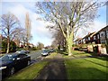
Park Road North
Suburban street on the north side of Chester-le-Street.
Image: © Robert Graham
Taken: 6 Feb 2013
0.13 miles
2
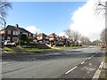
Park Road North, Chester-le-Street
A wide residential street in Chester-le-Street with semi detached houses on both sides of the road.
Image: © Graham Robson
Taken: 17 Mar 2018
0.13 miles
3

Chester-le-Street : A1(M)
Looking north on the A1(M).
Image: © Lewis Clarke
Taken: 21 Sep 2020
0.14 miles
4
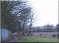
Footpath from the banks of the River Wear to Chester-le-Street
Image: © Peter Robinson
Taken: 13 Feb 2011
0.16 miles
5

Northbound A1(M) at Junction 63 (Blind Lane Interchange)
Image: © David Dixon
Taken: 29 Apr 2019
0.17 miles
6
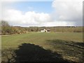
Arable field, Chester-le-Street
An arable field on the edge of Chester-le-Street. The field is bounded by the A167 and A1 roads, a sewage works and the River Wear.
Image: © Graham Robson
Taken: 17 Mar 2018
0.17 miles
7
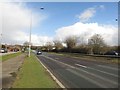
The A167, Chester-le-Street
Looking along the northbound carriageway of the A167 on the eastern edge of Chester-le-Street.
Image: © Graham Robson
Taken: 17 Mar 2018
0.17 miles
8
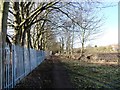
Path from the river
This path leads from the River Wear towards the A167, on the east side of Chester-le-Street. The steel fence is around the sewage works.
Image: © Robert Graham
Taken: 6 Feb 2013
0.17 miles
9

Chester-le-Street : A1(M) Junction 63
At Junction 63, Blind Lane.
Image: © Lewis Clarke
Taken: 21 Sep 2020
0.18 miles
10

Bend in the River Wear, Chester-le-Street
A meander in the River Wear as it flows past the eastern side of Chester-le-Street. Recent wet weather means the river is carrying more water than normal.
Image: © Graham Robson
Taken: 17 Mar 2018
0.18 miles