1
Butchers Arms, Middle Chare, Chester-le-Street
Image: © Alexander P Kapp
Taken: 25 Aug 2011
0.01 miles
2
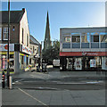
Chester-le-Street: Front Street and the parish church
A view towards the church of St Mary and St Cuthbert on a bright September morning.
Image: © John Sutton
Taken: 18 Sep 2013
0.02 miles
3
Front Street, Chester-le-Street
The main shopping street in the centre of Chester-le-Street.
Image: © Graham Robson
Taken: 17 Mar 2018
0.03 miles
4
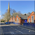
Chester-le-Street: Church Chare on an April evening
The tall spire of the parish church of St Mary and St Cuthbert and the red-brick Cestria Primary School.
Image: © John Sutton
Taken: 23 Apr 2022
0.04 miles
5
Front Street, Chester-le-Street
Looking along the main shopping street in the centre of Chester-le-Street.
Image: © Graham Robson
Taken: 17 Mar 2018
0.04 miles
6
Front Street, Chester-le-Street
Looking north along the main shopping area in Chester-le-Street.
Image: © Graham Robson
Taken: 17 Mar 2018
0.05 miles
7
Front Street, Chester-le-Street
Image: © Alexander P Kapp
Taken: 25 Aug 2011
0.05 miles
8
Fire Engine on Front Street
A 'Fire Safety' call. A tender from Durham and Darlington Fire Service.
Image: © David Clark
Taken: 31 Oct 2013
0.05 miles
9
Bethel Church, Low Chare, Chester-le-Street
Image: © Alexander P Kapp
Taken: 25 Aug 2011
0.05 miles
10
Benchmark on buttress on west face of St Mary and St Cuthbert Church
1GL bolt benchmark levelled at 21.879m above Newlyn Datum verified 1962. It was originally levelled at 73.439 feet above Liverpool Datum during the 1842-1845 Selby to Newcastle-upon-Tyne 1GL Survey. The surveyor's description was: 'No. 213. Bolt in North abutment of West face of Chester-le-Street Church tower ; 1.64 ft. above surface'
Image: © Roger Templeman
Taken: 11 Oct 2022
0.05 miles


