
IMAGES TAKEN NEAR TO
Adelaide Street, CHESTER LE STREET, DH3 3HY
Introduction
This page details the photographs taken nearby to Adelaide Street, DH3 3HY by members of the Geograph project.
The Geograph project started in 2005 with the aim of publishing, organising and preserving representative images for every square kilometre of Great Britain, Ireland and the Isle of Man.

There are currently over 7.5m images from over14,400 individuals and you can help contribute to the project by visiting https://www.geograph.org.uk
Image Map
Images are licensed for reuse under creativecommons.org/licenses/by-sa/2.0
Notes
- Clicking on the map will re-center to the selected point.
- The higher the marker number, the further away the image location is from the centre of the postcode.
Image Listing (59 Images Found)
Images are licensed for reuse under creativecommons.org/licenses/by-sa/2.0
Image
Details
Distance
2
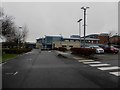
Chester-le-Street Community Hospital
The small hospital providing healthcare services to the population of Chester-le-Street and the surrounding area.
Image: © Graham Robson
Taken: 17 Mar 2018
0.04 miles

6

The Wicket Gate
The local Wetherspoons or "Spoons" located on the southern end of Front Street. The name is a connection to the local cricket club and ground on nearby Ropery Lane - their home since the 1860's
Image: © Chris Heaton
Taken: 17 May 2023
0.07 miles
7
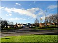
Chester-le-Street Hospital
Located at the south end of the main street.
Image: © Robert Graham
Taken: 28 Nov 2012
0.09 miles
8
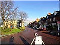
South end of Front Street, Chester-le-Street
This is the bottom end of the main shopping street in the town. In times past, this was The Great North Road, the main route between London and Edinburgh, and the town was an important stopping place.
Image: © Robert Graham
Taken: 28 Nov 2012
0.09 miles
9
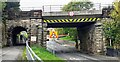
Bridge ECM5 219 taking East Coast Main Line over West Lane
Ordnance Survey documents indicate that a rivet benchmark levelled at 32.803m above Newlyn Datum was verified in 1962 on the bridge wall, at its far end, on the right hand side of the road
Image: © Roger Templeman
Taken: 11 Oct 2022
0.09 miles
10
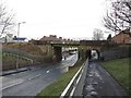
Railway bridge crossing Waldridge Road, Chester-le-Street
The East Cost Mainline crossing over Waldridge Road to the south of the railway station in Chester-le-Street.
Image: © Graham Robson
Taken: 17 Mar 2018
0.09 miles