IMAGES TAKEN NEAR TO
Northumberland Place, CHESTER LE STREET, DH3 2AR
Introduction
This page details the photographs taken nearby to Northumberland Place, DH3 2AR by members of the Geograph project.
The Geograph project started in 2005 with the aim of publishing, organising and preserving representative images for every square kilometre of Great Britain, Ireland and the Isle of Man.

There are currently over 7.5m images from over14,400 individuals and you can help contribute to the project by visiting https://www.geograph.org.uk
Image Map
Images are licensed for reuse under creativecommons.org/licenses/by-sa/2.0
Notes
- Clicking on the map will re-center to the selected point.
- The higher the marker number, the further away the image location is from the centre of the postcode.
Image Listing (5 Images Found)
Images are licensed for reuse under creativecommons.org/licenses/by-sa/2.0
Image
Details
Distance
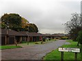
3
Houses at Barley Mow
The semi-detached homes are at the south side of Vigo Lane and are in the Barley Mow district of Birtley. The boundary between County Durham and the Metropolitan Borough of Gateshead runs along the centre of Vigo Lane.
Image: © Trevor Littlewood
Taken: 25 Apr 2016
0.21 miles
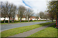
4
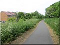
Old mineral railway, Vigo
Now part of the Coast to Coast cycle route, this used to be a railway serving collieries. The area became built up during the second half of the twentieth century.
Image: © Richard Webb
Taken: 18 Jun 2013
0.22 miles