IMAGES TAKEN NEAR TO
Lingholme, CHESTER LE STREET, DH2 2TP
Introduction
This page details the photographs taken nearby to Lingholme, DH2 2TP by members of the Geograph project.
The Geograph project started in 2005 with the aim of publishing, organising and preserving representative images for every square kilometre of Great Britain, Ireland and the Isle of Man.

There are currently over 7.5m images from over14,400 individuals and you can help contribute to the project by visiting https://www.geograph.org.uk
Image Map
Images are licensed for reuse under creativecommons.org/licenses/by-sa/2.0
Notes
- Clicking on the map will re-center to the selected point.
- The higher the marker number, the further away the image location is from the centre of the postcode.
Image Listing (9 Images Found)
Images are licensed for reuse under creativecommons.org/licenses/by-sa/2.0
Image
Details
Distance
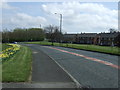
1
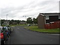
Junction Wynyard and Whitehill Way
In Chester-le-Street.
Image: © James Denham
Taken: 27 Jun 2014
0.15 miles
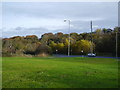
2
Open fields at the east of Pelton Fell
On the north side of Pelton Fell Road. There is a small section of countryside here before coming into Chester le Street town centre. There is some sort of storage site here with a large shed.
Image: © Robert Graham
Taken: 14 Oct 2019
0.19 miles
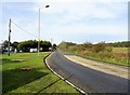
3
Junction with Chester le Street road Pelton Fell
Image: © P Glenwright
Taken: 12 Nov 2006
0.21 miles
4
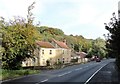
Houses at Chester Burn
There is a little group of cottages here beside Pelton Fell Road in Stella Gill at Chester le Street. Probably late Victorian in date.
Image: © Robert Graham
Taken: 14 Oct 2019
0.21 miles
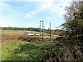
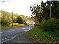
5
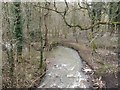
Twizell Burn, Pelton Fell
A stream flowing through woodland before it crosses under the road between Pelton Fell and Chester-le-Street.
Image: © Graham Robson
Taken: 17 Mar 2018
0.22 miles
6
Bottom of Burnhouse Bank, Pelton
This road leads down from Newfield to join Pelton Fell Road here.
Image: © Robert Graham
Taken: 14 Oct 2019
0.24 miles
7
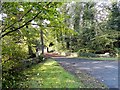
Whitehill Bridge
This driveway leads off Pelton Fell Road at Chester le Street, and across the Cong Burn. This is along Stella Gill, a wooded ravine on the west side of the town.
Image: © Robert Graham
Taken: 14 Oct 2019
0.24 miles
9
Glen Terrace on the outskirts of Chester le Street
Image: © P Glenwright
Taken: 12 Nov 2006
0.25 miles