
IMAGES TAKEN NEAR TO
The Close East, CHESTER LE STREET, DH2 2EY
Introduction
This page details the photographs taken nearby to The Close East, DH2 2EY by members of the Geograph project.
The Geograph project started in 2005 with the aim of publishing, organising and preserving representative images for every square kilometre of Great Britain, Ireland and the Isle of Man.

There are currently over 7.5m images from over14,400 individuals and you can help contribute to the project by visiting https://www.geograph.org.uk
Image Map
Images are licensed for reuse under creativecommons.org/licenses/by-sa/2.0
Notes
- Clicking on the map will re-center to the selected point.
- The higher the marker number, the further away the image location is from the centre of the postcode.
Image Listing (6 Images Found)
Images are licensed for reuse under creativecommons.org/licenses/by-sa/2.0
Image
Details
Distance
1
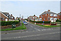
Chester-le-Street: Arcadia Avenue
Off Newcastle Road, north of the town centre.
Image: © John Sutton
Taken: 22 Apr 2022
0.21 miles
2
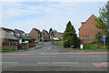
Chester-le-Street: Highfield Rise
Off Newcastle Road, north of the town centre.
Image: © John Sutton
Taken: 22 Apr 2022
0.23 miles
3
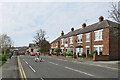
Chester-le-Street: on Newcastle Road
Nearing the centre of the town on an April morning.
Image: © John Sutton
Taken: 22 Apr 2022
0.23 miles
4
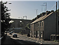
Chester-le-Street: a bright September morning
A picture of the approach to the railway viaduct on Pelton Fell Road, taken into strong early-morning sunlight.
Image: © John Sutton
Taken: 18 Sep 2013
0.24 miles
5
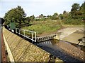
River works at Chester le Street
There has been a lot of flood alleviation work carried out here recently, on the Chester Burn at North Burns. This seems to be a barrier to prevent debris from being carried into the culvert under the market place.
Image: © Robert Graham
Taken: 14 Oct 2019
0.24 miles
6
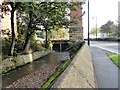
Culvert entrance at Chester le Street
This carries the Chester Burn under the market Place in the town centre at North Burns. There has been a lot of work carried out here recently. The big pier is for the railway viaduct.
Image: © Robert Graham
Taken: 14 Oct 2019
0.24 miles