IMAGES TAKEN NEAR TO
High Hold, Pelton, CHESTER LE STREET, DH2 1PG
Introduction
This page details the photographs taken nearby to DH2 1PG by members of the Geograph project.
The Geograph project started in 2005 with the aim of publishing, organising and preserving representative images for every square kilometre of Great Britain, Ireland and the Isle of Man.

There are currently over 7.5m images from over14,400 individuals and you can help contribute to the project by visiting https://www.geograph.org.uk
Image Map
Images are licensed for reuse under creativecommons.org/licenses/by-sa/2.0
Notes
- Clicking on the map will re-center to the selected point.
- The higher the marker number, the further away the image location is from the centre of the postcode.
Image Listing (14 Images Found)
Images are licensed for reuse under creativecommons.org/licenses/by-sa/2.0
Image
Details
Distance
1
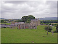
Pill box
Located close to a public footpath on grazing land at Moss Close Farm, Pelton.
Image: © Richard Dorrell
Taken: 26 Jul 2011
0.09 miles
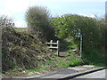
2
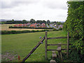
Footpath towards Pelton
This footpath runs along the edge of grazing land. The road to the right of the housing is The Parade, Pelton.
Image: © Richard Dorrell
Taken: 26 Jul 2011
0.11 miles
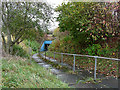
5
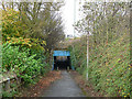
Subway under the A693
This subway enables pedestrians and cyclists to travel between Pelton and High Handenhold without crossing the busy A693 at grade.
Image: © Oliver Dixon
Taken: 31 Oct 2014
0.12 miles
6
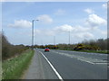
A693 heading east
Towards Chester-le-Street.
Image: © JThomas
Taken: 2 May 2013
0.14 miles
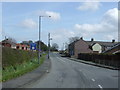
7
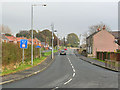
The Parade, Pelton
At the western end of the village.
Image: © Oliver Dixon
Taken: 31 Oct 2014
0.14 miles
8
Subway under the A693
This subway enables pedestrians and cyclists to travel between Pelton and High Handenhold without crossing the busy A693 at grade.
Image: © Oliver Dixon
Taken: 31 Oct 2014
0.14 miles
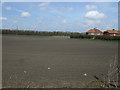
9
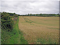
Footpath by a wheat field
The little-used footpath connects Pelton to West Pelton.
Image: © Richard Dorrell
Taken: 26 Jul 2011
0.14 miles