
IMAGES TAKEN NEAR TO
Drum Park, CHESTER LE STREET, DH2 1AE
Introduction
This page details the photographs taken nearby to Drum Park, DH2 1AE by members of the Geograph project.
The Geograph project started in 2005 with the aim of publishing, organising and preserving representative images for every square kilometre of Great Britain, Ireland and the Isle of Man.

There are currently over 7.5m images from over14,400 individuals and you can help contribute to the project by visiting https://www.geograph.org.uk
Image Map
Images are licensed for reuse under creativecommons.org/licenses/by-sa/2.0
Notes
- Clicking on the map will re-center to the selected point.
- The higher the marker number, the further away the image location is from the centre of the postcode.
Image Listing (16 Images Found)
Images are licensed for reuse under creativecommons.org/licenses/by-sa/2.0
Image
Details
Distance

2

Factories on the Drum Industrial Estate
This estate is to the north of Chester-le-Street.
Image: © Robert Graham
Taken: 6 Feb 2013
0.05 miles
4

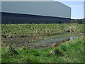
Small pool known locally as "Batleys Pond"
On waste land between Birtley and Chester Le Street in County Durham.
Drum Industrial Estate in the background.
Image: © Chris Tweedy
Taken: Unknown
0.12 miles
5
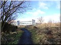
Path to the Industrial Estate
This footpath from a nearby housing estate leads to the Drum Industrial Estate on the north side of Chester-le-Street.
Image: © Robert Graham
Taken: 6 Feb 2013
0.12 miles
6

Pond on the industrial estate
This small pond on the edge of the Drum Industrial Estate at Chester-le-Street is presumably a remnant of the former landscape.
Image: © Robert Graham
Taken: 6 Feb 2013
0.13 miles
7
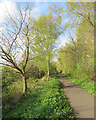
Cycle path on former railway
The Consett and Sunderland cycle path near South Pelaw, photographed just before eight o'clock on a fine spring morning.
Image: © John Sutton
Taken: 24 Apr 2022
0.17 miles
8
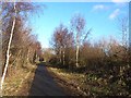
Consett and Sunderland Railway Path at South Pelaw
The Consett and Sunderland Railway Path forms part of National Cycle Network route 7 and the famous C2C Cycle Route. This section of the path is tarmac.
Image: © Oliver Dixon
Taken: 8 Jan 2014
0.17 miles
9

Bridge on the old railway
This bridge on the old railway walk near South Pelaw is over a footpath leading to the Drum Industrial Estate.
Image: © Robert Graham
Taken: 6 Feb 2013
0.17 miles
10
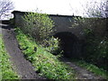
Old railway bridge
Now carries a cycle trail.
Image: © JThomas
Taken: 2 May 2013
0.18 miles