
IMAGES TAKEN NEAR TO
Beechcrest, DURHAM, DH1 4QF
Introduction
This page details the photographs taken nearby to Beechcrest, DH1 4QF by members of the Geograph project.
The Geograph project started in 2005 with the aim of publishing, organising and preserving representative images for every square kilometre of Great Britain, Ireland and the Isle of Man.

There are currently over 7.5m images from over14,400 individuals and you can help contribute to the project by visiting https://www.geograph.org.uk
Image Map
Images are licensed for reuse under creativecommons.org/licenses/by-sa/2.0
Notes
- Clicking on the map will re-center to the selected point.
- The higher the marker number, the further away the image location is from the centre of the postcode.
Image Listing (78 Images Found)
Images are licensed for reuse under creativecommons.org/licenses/by-sa/2.0
Image
Details
Distance
1
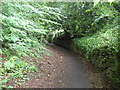
Footpath to Crossgate Peth, Durham
Climbing gradually from Margery Lane.
Image: © Richard Vince
Taken: 19 Jun 2019
0.03 miles
2
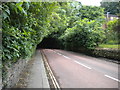
Western part of Margery Lane, Durham
Heading into the woods north of Durham School.
Image: © Richard Vince
Taken: 19 Jun 2019
0.07 miles
3
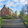
Durham: Crossgate Peth
Morning sunlight on Easter Monday.
Image: © John Sutton
Taken: 17 Apr 2017
0.07 miles
4
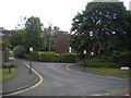
Briardene, Durham
A bifurcating cul de sac off Margery Lane.
Image: © Richard Vince
Taken: 19 Jun 2019
0.09 miles
5
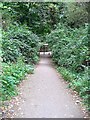
Clay Lane, connecting Margery Lane and Sheraton Park
Image: © Roger Smith
Taken: 16 Sep 2007
0.09 miles
6
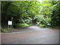
East end of Clay Lane, Durham
Off Margery Lane, leading to the Durham Archery Lawn Tennis Club and hosting a public footpath.
Image: © Richard Vince
Taken: 19 Jun 2019
0.09 miles
7
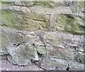
Ordnance Survey Cut Mark
This OS cut mark can be found on the wall south side of the Road. It marks a point 70.122m above mean sea level.
Image: © Adrian Dust
Taken: 15 Sep 2018
0.11 miles
8
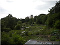
Allotment gardens off Margery Lane, Durham
With the three towers of Durham Cathedral (on the other side of the River Wear) visible in the distance.
Image: © Richard Vince
Taken: 19 Jun 2019
0.11 miles
9
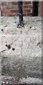
Ordnance Survey Pivot
This OS pivot can be found on the wall of No25 The Avenue. It marks a point 75.130m above mean sea level.
Image: © Adrian Dust
Taken: 14 Sep 2018
0.12 miles
10
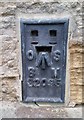
Ordnance Survey Flush Bracket (S2095)
This OS Flush Bracket can be found on the SE face of St John's Church. It marks a point 102.007m above mean sea level.
Image: © Adrian Dust
Taken: 14 Sep 2018
0.12 miles