IMAGES TAKEN NEAR TO
Cross View Terrace, DURHAM, DH1 4JY

Introduction

This page details the photographs taken nearby to Cross View Terrace, DH1 4JY by members of the Geograph project.

The Geograph project started in 2005 with the aim of publishing, organising and preserving representative images for every square kilometre of Great Britain, Ireland and the Isle of Man.

There are currently over 7.5m images from over14,400 individuals and you can help contribute to the project by visiting https://www.geograph.org.uk

Image Map


Images are licensed for reuse under creativecommons.org/licenses/by-sa/2.0
Notes
  • Clicking on the map will re-center to the selected point.
  • The higher the marker number, the further away the image location is from the centre of the postcode.

Image Listing (23 Images Found)

Images are licensed for reuse under creativecommons.org/licenses/by-sa/2.0
  • ...
Image
Details
Distance
1
Junction of the A690 and A167
With Michelangelo's Bar and Restaurant to the left of the photo
Image: © Alexander P Kapp Taken: 24 Jun 2011
0.04 miles
2
Neville's Cross Junction
The A167 at Neville's Cross Durham.
Image: © Gordon Griffiths Taken: 28 Jun 2008
0.05 miles
3
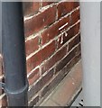
Ordnance Survey Cut Mark
This OS cut mark can be found on Ashville, Nevilles Cross Bank. It marks a point 88.084m above mean sea level.
Image: © Adrian Dust Taken: 14 Sep 2018
0.05 miles
4
Michelangelo, Neville's Cross
The Michelangelo bar and ristorante at the Nevill'e Cross junction on the A167, Darlington Road.
Image: © David Dixon Taken: 22 Jun 2011
0.05 miles
5
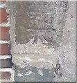
Ordnance Survey Cut Mark
This OS cut mark can be found on No9 Darlington Road. It marks a point 95.710m above mean sea level.
Image: © Adrian Dust Taken: 14 Sep 2018
0.10 miles
6
Ordnance Survey Cut Mark
This OS cut mark can be found on the wall NW end of George Street. It marks a point 100.267m above mean sea level.
Image: © Adrian Dust Taken: 14 Sep 2018
0.11 miles
7
Saint John's
A C of E Church at Neville's Cross Durham.
Image: © Gordon Griffiths Taken: 28 Jun 2008
0.11 miles
8
St John's Church, Neville's Cross
Image: © JThomas Taken: 28 Nov 2015
0.11 miles
9
Ordnance Survey Flush Bracket S2095
This can be found on the rear wall of St John's Church.
Image: © Peter Wood Taken: 17 Jan 2012
0.11 miles
10
Ordnance Survey Cut Mark
This OS cut mark can be found on the gatepost of No4 Kells Terrace. It marks a point 78.242m above mean sea level.
Image: © Adrian Dust Taken: 14 Sep 2018
0.12 miles
  • ...