
IMAGES TAKEN NEAR TO
May Street, DURHAM, DH1 4EN
Introduction
This page details the photographs taken nearby to May Street, DH1 4EN by members of the Geograph project.
The Geograph project started in 2005 with the aim of publishing, organising and preserving representative images for every square kilometre of Great Britain, Ireland and the Isle of Man.

There are currently over 7.5m images from over14,400 individuals and you can help contribute to the project by visiting https://www.geograph.org.uk
Image Map
Images are licensed for reuse under creativecommons.org/licenses/by-sa/2.0
Notes
- Clicking on the map will re-center to the selected point.
- The higher the marker number, the further away the image location is from the centre of the postcode.
Image Listing (86 Images Found)
Images are licensed for reuse under creativecommons.org/licenses/by-sa/2.0
Image
Details
Distance
1
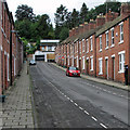
Durham: up May Street
Late 19th-century terraces and some modern infill at the top.
Image: © John Sutton
Taken: 2 Sep 2016
0.03 miles
2
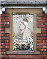
Durham: May Street date stone
The first house on May Street is Jubilee Cottage (see Image]), built to commemorate the Queen Empress's Diamond Jubilee in 1897.
Image: © John Sutton
Taken: 2 Sep 2016
0.03 miles
3
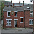
Durham: May Street
For a closer look at the Diamond Jubilee date stone, see Image
Image: © John Sutton
Taken: 2 Sep 2016
0.03 miles
4
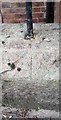
Ordnance Survey Pivot
This OS pivot can be found on the wall of No25 The Avenue. It marks a point 75.130m above mean sea level.
Image: © Adrian Dust
Taken: 14 Sep 2018
0.05 miles
6
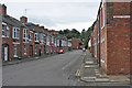
Durham: up Hawthorn Terrace
Seen from the corner of Lawson Terrace on a cloudy morning early in September.
Image: © John Sutton
Taken: 2 Sep 2016
0.07 miles
7
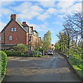
Durham: Crossgate Peth
Morning sunlight on Easter Monday.
Image: © John Sutton
Taken: 17 Apr 2017
0.08 miles
8
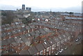
Roofscape of Durham
Laburnum Avenue is the road in the foreground. Durham Cathedral is in the background.
Image: © N Chadwick
Taken: 25 Feb 2011
0.10 miles
9
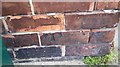
Ordnance Survey Cut Mark
This OS cut mark can be found on No36 Hawthorn Terrace. It marks a point 62.268m above mean sea level.
Image: © Adrian Dust
Taken: 14 Sep 2018
0.11 miles
10
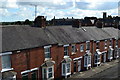
View over rooftops from Lawson Terrace towards Durham Cathedral
Image: © David Martin
Taken: 14 Sep 2013
0.12 miles