IMAGES TAKEN NEAR TO
Sherburn House, DURHAM, DH1 2SN
Introduction
This page details the photographs taken nearby to DH1 2SN by members of the Geograph project.
The Geograph project started in 2005 with the aim of publishing, organising and preserving representative images for every square kilometre of Great Britain, Ireland and the Isle of Man.

There are currently over 7.5m images from over14,400 individuals and you can help contribute to the project by visiting https://www.geograph.org.uk
Image Map
Images are licensed for reuse under creativecommons.org/licenses/by-sa/2.0
Notes
- Clicking on the map will re-center to the selected point.
- The higher the marker number, the further away the image location is from the centre of the postcode.
Image Listing (5 Images Found)
Images are licensed for reuse under creativecommons.org/licenses/by-sa/2.0
Image
Details
Distance
1
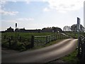
Byer's Garth
Byer's Garth Farm and farm buildings have recently been converted into dwellings.
Image: © Roger Smith
Taken: 7 Apr 2007
0.03 miles
4
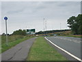
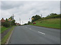
Cycle path leading to the A181/A688 junction
Image: © Peter Robinson
Taken: 12 Jul 2011
0.15 miles