IMAGES TAKEN NEAR TO
Angerstein Court, Broomside Lane, DURHAM, DH1 2QD
Introduction
This page details the photographs taken nearby to Angerstein Court, Broomside Lane, DH1 2QD by members of the Geograph project.
The Geograph project started in 2005 with the aim of publishing, organising and preserving representative images for every square kilometre of Great Britain, Ireland and the Isle of Man.

There are currently over 7.5m images from over14,400 individuals and you can help contribute to the project by visiting https://www.geograph.org.uk
Image Map
Images are licensed for reuse under creativecommons.org/licenses/by-sa/2.0
Notes
- Clicking on the map will re-center to the selected point.
- The higher the marker number, the further away the image location is from the centre of the postcode.
Image Listing (48 Images Found)
Images are licensed for reuse under creativecommons.org/licenses/by-sa/2.0
Image
Details
Distance
1
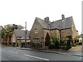
The Old School House, Belmont
On Broomside Lane. Opened in 1870, but now a private house.
Image: © Robert Graham
Taken: 16 Oct 2018
0.01 miles
3
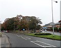
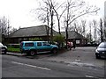
Road junction at Broomside Lane
The road joining from the left is Carrville High Street. Hidden in the trees is St Mary Magdalene church, obviously built at a strategic location at the junction of these two old roads.
Image: © Robert Graham
Taken: 16 Oct 2018
0.03 miles
4
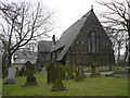
Church of St. Mary Magdalene
The Parish Church of Belmont near Durham City.
The church, in the Moor End area of Belmont, dates from 1856.
Image: © Chris Tweedy
Taken: 2 Feb 2006
0.03 miles
5
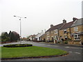
Moor End, Belmont
This is the site of the original village in Victorian times. Moor End Cottages are shown on the first Ordnance Survey map of 1861.
Image: © Robert Graham
Taken: 16 Oct 2018
0.03 miles
6
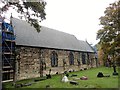
St mary Magdelane Church, Belmont
The parish church of Belmont, opened in 1857. It occupies a plot between High Street and Broomside Lane.
Image: © Robert Graham
Taken: 16 Oct 2018
0.04 miles
7
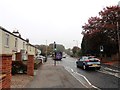
Bus on Carrville High Street
This is view north at the south end of the street at the junction with Broomside Lane. The bus is the Go Northeast No 20 service from Durham to Sunderland and then on to South Shields. This is a good service, with a bus every 10 minutes.
Image: © Robert Graham
Taken: 16 Oct 2018
0.05 miles
8
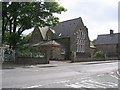
Former Belmont Primary School, now a private house
Image: © Roger Smith
Taken: 8 Jun 2007
0.05 miles