IMAGES TAKEN NEAR TO
Maureen Terrace, DURHAM, DH1 1SN
Introduction
This page details the photographs taken nearby to Maureen Terrace, DH1 1SN by members of the Geograph project.
The Geograph project started in 2005 with the aim of publishing, organising and preserving representative images for every square kilometre of Great Britain, Ireland and the Isle of Man.

There are currently over 7.5m images from over14,400 individuals and you can help contribute to the project by visiting https://www.geograph.org.uk
Image Map
Images are licensed for reuse under creativecommons.org/licenses/by-sa/2.0
Notes
- Clicking on the map will re-center to the selected point.
- The higher the marker number, the further away the image location is from the centre of the postcode.
Image Listing (14 Images Found)
Images are licensed for reuse under creativecommons.org/licenses/by-sa/2.0
Image
Details
Distance
2
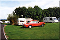
Durham Grange Caravan Club Site Meadow Lane
Image: © Jo and Steve Turner
Taken: 29 Aug 1999
0.06 miles
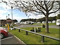
3
Grange Caravan Club Site
Meadow Lane, just off the A1 roundabout.
Image: © Jo and Steve Turner
Taken: 25 Jul 2010
0.09 miles
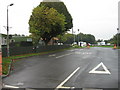
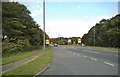
4
Camp Site View
The view of Grange Caravan Club Site near junction 62 on the A1(M).
Image: © Gordon Griffiths
Taken: 17 Aug 2014
0.09 miles
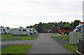
5
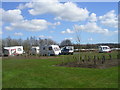
Grange Caravan Club Site - Durham
General view of caravan site. The site is very handy for the A1 and easy access to Durham via the nearby Park & Ride
Image: © David Grimshaw
Taken: 14 Apr 2006
0.10 miles
7
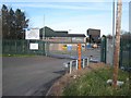
Highways Authority Depot, Belmont, Durham
Adjacent to Junction 62 on the A1(M).
Image: © Oliver Dixon
Taken: 21 Mar 2007
0.15 miles
8
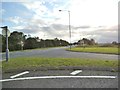
Meadow Lane View
The view down the A690 near junction 62 on the A1(M) at Durham.
Image: © Gordon Griffiths
Taken: 17 Aug 2014
0.15 miles
9
A1(M) Island
The view down the A690 towards the Junction 62 Island on the A1(M) at Durham.
Image: © Gordon Griffiths
Taken: 17 Aug 2014
0.18 miles
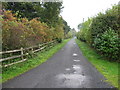
10
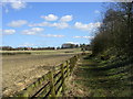
Beside A690
The path is in the bottom of the embankment for the A690 Durham to Sunderland road. The path leads to the river wear in the opposite direction
Image: © David Grimshaw
Taken: 14 Apr 2006
0.20 miles