IMAGES TAKEN NEAR TO
Ferens Close, DURHAM, DH1 1JX
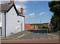
Introduction
This page details the photographs taken nearby to Ferens Close, DH1 1JX by members of the Geograph project.
The Geograph project started in 2005 with the aim of publishing, organising and preserving representative images for every square kilometre of Great Britain, Ireland and the Isle of Man.

There are currently over 7.5m images from over14,400 individuals and you can help contribute to the project by visiting https://www.geograph.org.uk
Image Map
Images are licensed for reuse under creativecommons.org/licenses/by-sa/2.0
Notes
- Clicking on the map will re-center to the selected point.
- The higher the marker number, the further away the image location is from the centre of the postcode.
Image Listing (65 Images Found)
Images are licensed for reuse under creativecommons.org/licenses/by-sa/2.0
Image
Details
Distance
1
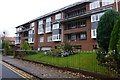
Flats at Ferens Park, Durham
Overlooking the River Wear.
Image: © Russel Wills
Taken: 22 Nov 2016
0.07 miles
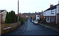
2
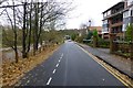
Orchard Drive, Durham
Ferens Park flats on the right and the River Wear on the left, visible now the leaves are off the trees!
Image: © Russel Wills
Taken: 22 Nov 2016
0.08 miles
3
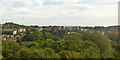
View towards northern outskirts of Durham
Image: © Robin Webster
Taken: 14 Sep 2019
0.09 miles
4
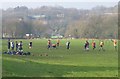
Quidditch on The Sands on Sunday
'In the fantasy world of the Harry Potter novels and movies, Quidditch is a magical competitive sport in involving flying contestants. Matches are played between two teams of seven players riding flying broomsticks, using four balls: a Quaffle, two Bludgers, and a Golden Snitch. Six ring-shaped goals are situated atop poles of different heights, three on each side of the pitch. It is an extremely rough but very popular semi-contact sport, played by wizards and witches. In the Wizarding World of the Harry Potter universe, Quidditch has a fervent fan following.' https://en.wikipedia.org/wiki/Quidditch
Image: © Russel Wills
Taken: 5 Feb 2017
0.11 miles
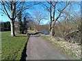
5
Mayorswell Field
All quiet on Christmas Day.
Image: © Russel Wills
Taken: 25 Dec 2018
0.12 miles
6
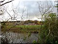
View across the river
Looking across the River Wear to the Gilesgate area of Durham City.
Image: © Robert Graham
Taken: 13 Nov 2013
0.12 miles
8
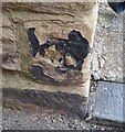
Ordnance Survey Cut Mark
This OS cut mark can be found on No18 Ellis Leazes Street. It marks a point 59.323m above mean sea level.
Image: © Adrian Dust
Taken: 14 Sep 2018
0.14 miles
10
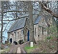
Orthodox Church of St Cuthbert and St Bede
The Orthodox parish of St Cuthbert and St Bede in Durham began in the autumn of 1996 as an initiative led by students and academic staff at Durham University. At that time, the nearest Orthodox parishes were in Newcastle and Middlesbrough, with services conducted almost entirely in Greek.
http://www.durhamorthodox.church/
http://www.durhamorthodox.church/the-new-church/
Image: © Russel Wills
Taken: 25 Dec 2023
0.15 miles