IMAGES TAKEN NEAR TO
Bradford Crescent, DURHAM, DH1 1ER
Introduction
This page details the photographs taken nearby to Bradford Crescent, DH1 1ER by members of the Geograph project.
The Geograph project started in 2005 with the aim of publishing, organising and preserving representative images for every square kilometre of Great Britain, Ireland and the Isle of Man.

There are currently over 7.5m images from over14,400 individuals and you can help contribute to the project by visiting https://www.geograph.org.uk
Image Map
Images are licensed for reuse under creativecommons.org/licenses/by-sa/2.0
Notes
- Clicking on the map will re-center to the selected point.
- The higher the marker number, the further away the image location is from the centre of the postcode.
Image Listing (13 Images Found)
Images are licensed for reuse under creativecommons.org/licenses/by-sa/2.0
Image
Details
Distance
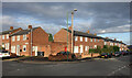
2
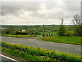
A690 Passing Kepier Lane
Kepier Lane is the access road for Kepier Farm and Kepier Hospital.
Image: © David Dixon
Taken: 21 May 2021
0.10 miles
3
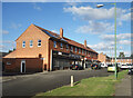
Shops on Gort Place
An off licence, a Chinese takeaway, a fish & chip shop and one that looks closed.
Image: © Des Blenkinsopp
Taken: 25 Aug 2022
0.11 miles
4
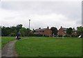
Children's Play Area between Wakenshaw Road and Long Acre
Image: © Roger Smith
Taken: 16 Jun 2007
0.14 miles
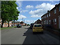
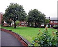
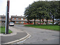
7
Corner of Roosevelt Road and Cooper Square
Part of a large area of housing built shortly after WW2.
Image: © Des Blenkinsopp
Taken: 25 Aug 2022
0.15 miles
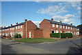
8
Corner of Roosevelt & Annand Roads
Part of a large area of post war development begun in the 1940s to meet the housing shortages at the end of the war. Street names are a mixture of well known figures of that time, ie US President Roosevelt, and local recipients of the Victoria Cross, in this case Captain Richard Annand, awarded a VC in WW2.
Image: © Des Blenkinsopp
Taken: 21 Aug 2022
0.15 miles
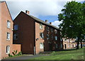
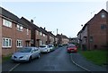
9
Cooper Square, Gilesgate, Durham
Housing on the Gilesgate Estate north of the Sunderland Road.
Image: © Rodney Burton
Taken: 26 Aug 2004
0.18 miles
10
View up Heaviside Place
Quiet on Christmas Day!
Image: © Russel Wills
Taken: 25 Dec 2018
0.19 miles