IMAGES TAKEN NEAR TO
Carrsdale, DURHAM, DH1 1BD
Introduction
This page details the photographs taken nearby to Carrsdale, DH1 1BD by members of the Geograph project.
The Geograph project started in 2005 with the aim of publishing, organising and preserving representative images for every square kilometre of Great Britain, Ireland and the Isle of Man.

There are currently over 7.5m images from over14,400 individuals and you can help contribute to the project by visiting https://www.geograph.org.uk
Image Map
Images are licensed for reuse under creativecommons.org/licenses/by-sa/2.0
Notes
- Clicking on the map will re-center to the selected point.
- The higher the marker number, the further away the image location is from the centre of the postcode.
Image Listing (17 Images Found)
Images are licensed for reuse under creativecommons.org/licenses/by-sa/2.0
Image
Details
Distance
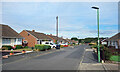
1
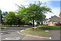
High Street, Carrville
At the junction with Dene Drive.
Image: © Des Blenkinsopp
Taken: 23 Aug 2022
0.06 miles
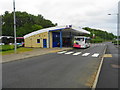
2
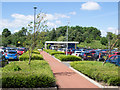
Planted beds at Belmont Park and Ride
Durham has three park and ride termini. Belmont and Sniperley are connected by a single route passing through the city centre; the other terminus, Howlands, has a service only to and from the city.
The beds are planted with low-maintenance species.
Image: © Trevor Littlewood
Taken: 7 Jun 2017
0.11 miles
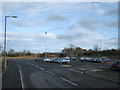
3
Belmont Park and Ride Terminus Durham City
Image: © Ann Clare
Taken: 11 Jul 2009
0.11 miles
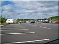
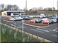
4
Entrance and exit road for Belmont Park and Ride Station
Image: © Peter Robinson
Taken: 18 May 2011
0.12 miles
6
Belmont Park+Ride
Provides a quick and frequent service into Durham city centre.
Image: © John M
Taken: 16 Jul 2018
0.13 miles
7
Extension at Durham Belmont Park and Ride Station
Recently completed see http://www.geograph.org.uk/photo/2415151
Image: © Peter Robinson
Taken: 21 Feb 2012
0.14 miles
8
Belmont Park-and-Ride, Durham
This is one of three Park-and-Ride sites around the City of Durham. The programme was rolled out a couple of years ago, and was the first example in the country of a comprehensive Park-and-Ride scheme being implemented complete in one fell swoop. Simultaneously with the opening of the scheme, a number of bus lanes were established, further parking restrictions were introduced within the City centre and parking charges within the centre were substantially increased. http://www.durham.gov.uk/parkride/usp.nsf/pws/Durham+Park+and+Ride+-+Home+Page
Image: © Oliver Dixon
Taken: 21 Mar 2007
0.15 miles
9
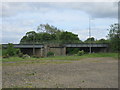
Railway bridge over the A690 at Carrville
Image: © Peter Robinson
Taken: 18 May 2011
0.18 miles
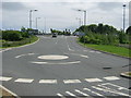
10
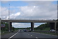
Overbridge, Junction 62, A1(M)
The Durham and Sunderland turn off.
Image: © N Chadwick
Taken: 29 May 2011
0.21 miles