
IMAGES TAKEN NEAR TO
Drummore, STRANRAER, DG9 9HF
Introduction
This page details the photographs taken nearby to DG9 9HF by members of the Geograph project.
The Geograph project started in 2005 with the aim of publishing, organising and preserving representative images for every square kilometre of Great Britain, Ireland and the Isle of Man.

There are currently over 7.5m images from over14,400 individuals and you can help contribute to the project by visiting https://www.geograph.org.uk
Image Map
Images are licensed for reuse under creativecommons.org/licenses/by-sa/2.0
Notes
- Clicking on the map will re-center to the selected point.
- The higher the marker number, the further away the image location is from the centre of the postcode.
Image Listing (34 Images Found)
Images are licensed for reuse under creativecommons.org/licenses/by-sa/2.0
Image
Details
Distance
1
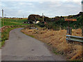
"Glen of the Hole"
Looking south along the access road to Castle Clanyard Farm
Image: © Brian Wotherspoon
Taken: 12 Sep 2007
0.03 miles
5
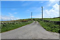
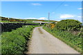
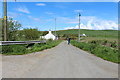
Road to Kirkmaiden from Low Clanyard
Image: © Billy McCrorie
Taken: 12 May 2014
0.07 miles
9
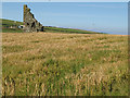
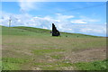
Castle Clanyard
Enigmatic ruins seen over the barley crop.
From the Royal Commission on the Ancient and Historical Monuments of Scotland:
"The remains of tower-house, probably dating to the late 16th century, stand in a field 70m ENE of Low Clanyard farmsteading, and comprise a substantial part of the W gable (6.5m high, 5.4m wide and 0.7m thick) and a fragment of its adjoining N wall. The gable incorporates three internally splayed windows and the cut-back haunches for a ground-floor vault. The tower was built for the Gordons of Clanyard and is recorded as ruinous in 1684."
Image: © Jonathan Wilkins
Taken: 10 Aug 2012
0.11 miles
10

Castle Clanyard
The farm is Low Clanyard.
Image: © Billy McCrorie
Taken: 12 May 2014
0.11 miles