
IMAGES TAKEN NEAR TO
West Freugh, STRANRAER, DG9 9DW
Introduction
This page details the photographs taken nearby to DG9 9DW by members of the Geograph project.
The Geograph project started in 2005 with the aim of publishing, organising and preserving representative images for every square kilometre of Great Britain, Ireland and the Isle of Man.

There are currently over 7.5m images from over14,400 individuals and you can help contribute to the project by visiting https://www.geograph.org.uk
Image Map
Images are licensed for reuse under creativecommons.org/licenses/by-sa/2.0
Notes
- Clicking on the map will re-center to the selected point.
- The higher the marker number, the further away the image location is from the centre of the postcode.
Image Listing (5 Images Found)
Images are licensed for reuse under creativecommons.org/licenses/by-sa/2.0
Image
Details
Distance
1
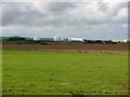
West Freugh Airfield
View of the base taken from the B7084.
Image: © Andy Farrington
Taken: 6 Oct 2010
0.10 miles
2
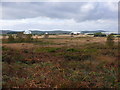
West Freugh Airfield
View across to the airfield from the B7084 at RV Point D.
Image: © Andy Farrington
Taken: 6 Oct 2010
0.11 miles
3
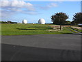
West Freugh Airfield
View of these two large golf balls at the airfield better known as Radomes which form part of the satellite ground station at the base. The picture was taken from the access road which leads to the main gate and is outside the perimeter fencing.
Image: © Andy Farrington
Taken: 6 Oct 2010
0.14 miles
4
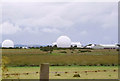
West Freugh Airfield
Radar Domes at this airfield which if we are to believe the MOD is disused.
Image: © John McLeish
Taken: 18 Jun 2005
0.16 miles
5
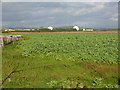
Low Mye
View across farm land to West Freugh.
Image: © Andy Farrington
Taken: 6 Oct 2010
0.24 miles