
IMAGES TAKEN NEAR TO
STRANRAER, DG9 9BY
Introduction
This page details the photographs taken nearby to DG9 9BY by members of the Geograph project.
The Geograph project started in 2005 with the aim of publishing, organising and preserving representative images for every square kilometre of Great Britain, Ireland and the Isle of Man.

There are currently over 7.5m images from over14,400 individuals and you can help contribute to the project by visiting https://www.geograph.org.uk
Image Map
Images are licensed for reuse under creativecommons.org/licenses/by-sa/2.0
Notes
- Clicking on the map will re-center to the selected point.
- The higher the marker number, the further away the image location is from the centre of the postcode.
Image Listing (12 Images Found)
Images are licensed for reuse under creativecommons.org/licenses/by-sa/2.0
Image
Details
Distance
1
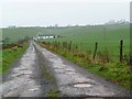
The road to Caldons Park
On a wet, misty and muddy late November day. The track to Caldons Park turns right at the cottage and continues on to the farm itself at top right of the picture.
Image: © Gordon Brown
Taken: 26 Nov 2007
0.09 miles
2
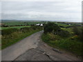
Caldons Hill
View along this small road that leads down to the A716. Centre of picture is Auchencloy Cottage.
Image: © Andy Farrington
Taken: 6 Oct 2010
0.12 miles
3
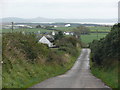
Caldons Hill
View east down this small road that leads to the A716. From the foreground to horizon can be seen - Auchencloy Cottage, Craigencrosh Farm, the golf balls at West Freugh Airfield (aka Radomes), the Danger Area and Bombing Range at Luce Bay, Auchenmalg and the Machars. All in all about at least a 10 mile plus view over Luce Bay as the crow flies.
Image: © Andy Farrington
Taken: 6 Oct 2010
0.13 miles
4
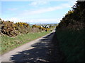
Auchencloy House
Passing Auchencloy the gorse lined lane from Awhirk descends east to the A716 near Stoneykirk.
Image: © Chris Newman
Taken: 31 Mar 2008
0.13 miles
5
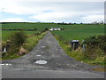
Caldons Park
View of the access road to the cottage and farm. Geographed previously in 2007 Image, although this time with better weather.
Image: © Andy Farrington
Taken: 6 Oct 2010
0.13 miles
6
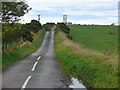
Auchencloy
View of this small road that runs past Auchencloy Cottage to Awhirk and the A77.
Image: © Andy Farrington
Taken: 6 Oct 2010
0.13 miles
7
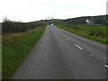
Caldons Park
View along the A716 in the direction of the South Rhins, Mains of Caldons farm is right of picture.
Image: © Andy Farrington
Taken: 6 Oct 2010
0.16 miles
8
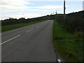
A716 to Stranraer
View along this road taken from near to Craigencrosh.
Image: © Andy Farrington
Taken: 6 Oct 2010
0.17 miles
9
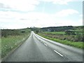
A716 heading towards Stoneykirk
The buildings of the Mains of Caldons can be seen in the distance.
Image: © Ann Cook
Taken: 25 Sep 2010
0.19 miles
10
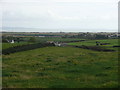
Caldons Hill
View from the hill across to Luce Bay, right of picture is Sotneykirk and the Parish Church now closed and boarded up. Mains of Caldons Farm is centre of picture.
Image: © Andy Farrington
Taken: 6 Oct 2010
0.21 miles