
IMAGES TAKEN NEAR TO
STRANRAER, DG9 9BN
Introduction
This page details the photographs taken nearby to DG9 9BN by members of the Geograph project.
The Geograph project started in 2005 with the aim of publishing, organising and preserving representative images for every square kilometre of Great Britain, Ireland and the Isle of Man.

There are currently over 7.5m images from over14,400 individuals and you can help contribute to the project by visiting https://www.geograph.org.uk
Image Map
Images are licensed for reuse under creativecommons.org/licenses/by-sa/2.0
Notes
- Clicking on the map will re-center to the selected point.
- The higher the marker number, the further away the image location is from the centre of the postcode.
Image Listing (12 Images Found)
Images are licensed for reuse under creativecommons.org/licenses/by-sa/2.0
Image
Details
Distance
3
Marrbury Smokehouse
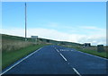
The mast is visible on Cairn Pat Image
Image: © Leslie Barrie
Taken: 11 Aug 2012
0.01 miles
5
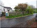
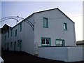
Colfin railway station (site), Dumfries & Galloway
Opened in 1862 by the Portpatrick Railway on what became the Portpatrick & Wigtownshire Joint Railway from Castle Douglas to Portpatrick, this station closed to passengers in 1950 and completely in 1959. The railway line was known as 'The Port Road'.
View east towards Stranraer and Castle Douglas, from where the railway crossed the road (to the right of the image). A length of platform is also visible to the east of the building, which is now a private residence.
Image: © Nigel Thompson
Taken: 8 May 2019
0.03 miles
7
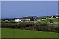
Fields north of Cowend Farm
View across fields to the Marrbury Smoke House and former railway station house to the left of the picture.
Image: © Andy Farrington
Taken: 15 Apr 2014
0.16 miles
8
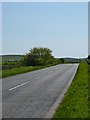
Craigenquarroch
View along the A77 towards Portpatrick.
Image: © Andy Farrington
Taken: 20 May 2012
0.16 miles
9
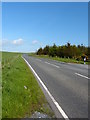
Spittal Croft
Looking along the A77 towards Lochans.
Image: © Andy Farrington
Taken: 20 May 2012
0.20 miles
10
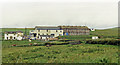
Colfin station (remains)
View southward from the A77 road: Stranraer Town (left)- Portpatrick (right) branch of the multi-owned Portpatrick & Wigtownshire Railway (Caledonian, G&SW, LNW & Midland) line from Castle Douglas - where it extended from the G&SW main line from Dumfries and Carlisle. Passenger services at Colfin station and on the line to Portpatrick ceased from 6/2/50, but goods to Colfin continued from Stranraer until 1/4/59. The buildings include the Marrbury Smokehouse and the station house. (Cf. Image] and others).
Image: © Ben Brooksbank
Taken: 6 Jul 1986
0.23 miles