IMAGES TAKEN NEAR TO
Murray Villas, Heugh Road, STRANRAER, DG9 8TE
Introduction
This page details the photographs taken nearby to Murray Villas, Heugh Road, DG9 8TE by members of the Geograph project.
The Geograph project started in 2005 with the aim of publishing, organising and preserving representative images for every square kilometre of Great Britain, Ireland and the Isle of Man.

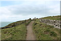
There are currently over 7.5m images from over14,400 individuals and you can help contribute to the project by visiting https://www.geograph.org.uk
Image Map
Images are licensed for reuse under creativecommons.org/licenses/by-sa/2.0
Notes
- Clicking on the map will re-center to the selected point.
- The higher the marker number, the further away the image location is from the centre of the postcode.
Image Listing (1277 Images Found)
Images are licensed for reuse under creativecommons.org/licenses/by-sa/2.0
Image
Details
Distance
1
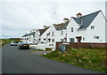
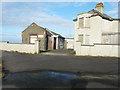
Housing near Radio Station, Portpatrick
Image: © Billy McCrorie
Taken: 20 Jan 2014
0.01 miles
2
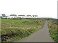
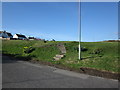
Looking towards Heugh Road
These houses are the old coastguard cottages and are still known by that name locally. The road is the access road for the radio mast.
On the right, it is just possible to see some wooden steps which lead down towards the cliff's edge. They mark the track of the Southern Upland Way.
Image: © Ann Cook
Taken: 22 Sep 2010
0.01 miles
4
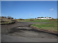
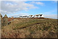
Turning Circle
Car park/turning circle with view over to the new development.
Image: © Billy McCrorie
Taken: 5 Mar 2012
0.04 miles
5
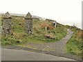
A pair of old gateposts
These gateposts are exactly the same as others on the Dunskey Estate. Historically, this whole area was once part of the estate. The path is The Southern Upland Way.
Image: © Ann Cook
Taken: 22 Sep 2010
0.05 miles
6
Hotel Golf Course
Steps up to the par three golf course.
Image: © Billy McCrorie
Taken: 5 Mar 2012
0.05 miles
8
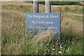
Portpatrick Hotel Golf Course Sign
Located just off the Heugh Road.
Image: © Billy McCrorie
Taken: 18 Jul 2020
0.06 miles
9
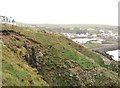
Erosion under the Southern Upland Way!
The Southern Upland Way is between two fences and the erosion on the cliff is directly under the path. This could be dangerous as this is a popular walk from the village.
Image: © Ann Cook
Taken: 22 Sep 2010
0.06 miles