IMAGES TAKEN NEAR TO
Dunragit, STRANRAER, DG9 8PF
Introduction
This page details the photographs taken nearby to DG9 8PF by members of the Geograph project.
The Geograph project started in 2005 with the aim of publishing, organising and preserving representative images for every square kilometre of Great Britain, Ireland and the Isle of Man.

There are currently over 7.5m images from over14,400 individuals and you can help contribute to the project by visiting https://www.geograph.org.uk
Image Map
Images are licensed for reuse under creativecommons.org/licenses/by-sa/2.0
Notes
- Clicking on the map will re-center to the selected point.
- The higher the marker number, the further away the image location is from the centre of the postcode.
Image Listing (22 Images Found)
Images are licensed for reuse under creativecommons.org/licenses/by-sa/2.0
Image
Details
Distance
1
Planting End, Castle Kennedy
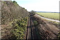
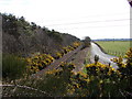
View east along the Stranraer-Glasgow railway, and a new local access road from the A75.
Image: © Chris Newman
Taken: 31 Mar 2008
0.03 miles
2
Planting End
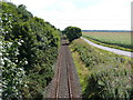
Similar shot to the First Geograph of this grid Image, view along the rail line.
Image: © Andy Farrington
Taken: 18 Aug 2010
0.05 miles
3
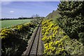
Bridge by Kirminnoch Cottage
View from the bridge of the rail track in the direction of Stranraer.
Image: © Andy Farrington
Taken: 15 Apr 2014
0.07 miles
4
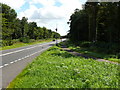
Planting End
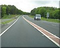
View along the A75 in the direction of Dunragit. Several tower cameras monitor the traffic on this route through to Gretna.
Image: © Andy Farrington
Taken: 18 Aug 2010
0.08 miles

6
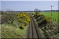
Kirminnoch
This is the view from the rail bridge that leads to Kirminnoch Cottage, looking south east with No 2Little Genoch Farm to the right.
Image: © Andy Farrington
Taken: 15 Apr 2014
0.11 miles
7
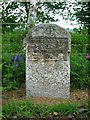
Old Milestone by the A75, Old Military Road, Inch parish
Stone post with metal plate by the A75, in parish of Inch (Wigtownshire District), on new three-lane road in woods, East of horses signs. Set back from road against wire fence
Inscription reads:-
STRANRAER
5
GLENLUCE
5
Carved bench mark on top.
Surveyed
Milestone Society National ID: DG_STGL05
Image: © Milestone Society
Taken: Unknown
0.11 miles
8
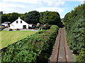
Planting End
View along the main Glasgow to Stranraer line in the direction of Stranraer. The shot is taken from what is described as a weak railway bridge. Left of picture is Bridge Cottage.
Image: © Andy Farrington
Taken: 18 Aug 2010
0.12 miles