IMAGES TAKEN NEAR TO
Burnbrae, STRANRAER, DG9 7SY
Introduction
This page details the photographs taken nearby to Burnbrae, DG9 7SY by members of the Geograph project.
The Geograph project started in 2005 with the aim of publishing, organising and preserving representative images for every square kilometre of Great Britain, Ireland and the Isle of Man.

There are currently over 7.5m images from over14,400 individuals and you can help contribute to the project by visiting https://www.geograph.org.uk
Image Map
Images are licensed for reuse under creativecommons.org/licenses/by-sa/2.0
Notes
- Clicking on the map will re-center to the selected point.
- The higher the marker number, the further away the image location is from the centre of the postcode.
Image Listing (45 Images Found)
Images are licensed for reuse under creativecommons.org/licenses/by-sa/2.0
Image
Details
Distance
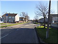
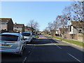
1
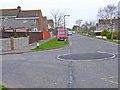
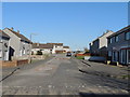
Ochtrelure Way, Stranraer
Post-war housing estate to the south-west of Stranraer.
Image: © Oliver Dixon
Taken: 30 Apr 2006
0.02 miles
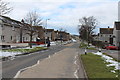
2
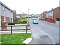
Gallowhill Rise, Stranraer
Modern estate on the south-west side of town.
Image: © Oliver Dixon
Taken: 30 Apr 2006
0.03 miles
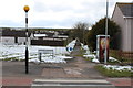
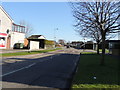
10
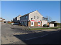
Spar Shop
Junction of Kerrsland Road & Ochtrelure Way.
Image: © Billy McCrorie
Taken: 26 Feb 2013
0.09 miles